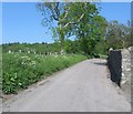
IMAGES TAKEN NEAR TO
Abernyte, PERTH, PH14 9SS

Introduction

This page details the photographs taken nearby to PH14 9SS by members of the Geograph project.

The Geograph project started in 2005 with the aim of publishing, organising and preserving representative images for every square kilometre of Great Britain, Ireland and the Isle of Man.

There are currently over 7.5m images from over14,400 individuals and you can help contribute to the project by visiting https://www.geograph.org.uk

Image Map


Images are licensed for reuse under creativecommons.org/licenses/by-sa/2.0
Notes
  • Clicking on the map will re-center to the selected point.
  • The higher the marker number, the further away the image location is from the centre of the postcode.

Image Listing (14 Images Found)

Images are licensed for reuse under creativecommons.org/licenses/by-sa/2.0
Image
Details
Distance
1
Track to Kirkton Farm near Abernyte
Image: © Douglas Nelson Taken: 18 Oct 2016
0.05 miles
2
Kirkton Farm
The farm of Kirkton of Abernyte anjoys a fine situation on the south-east slope of Kirkton Hill. Just to emphasise the ecclesiastical connection, the wood is Kirktonhill Wood, the steepest part of the hill is Kirkton Craig and the nearest cottage is Kirkton Farm Cottage. The kirk itself is about 300 yards further down the road, behind the photographer.
Image: © Anne Burgess Taken: 15 Aug 2010
0.14 miles
3
Minor road heading uphill
Away from the hamlet of Abernyte towards Kirkton road end.
Image: © James Denham Taken: 4 Jun 2010
0.18 miles
4
Abernyte Parish Kirk
A T-plan kirk, originally 17th century but remodelled in 1736, and twice repaired in the 19th century. For more details see http://hsewsf.sedsh.gov.uk/hslive/hsstart?P_HBNUM=5884. The kirk is a category B listed building, and the kirkyard category C(S).
Image: © Anne Burgess Taken: 15 Aug 2010
0.19 miles
5
Abernyte Parish Kirkyard
The kirkyard slopes quite steeply down from the south gable, with a triple lancet window obviously inserted after the kirk was built. For detailed views of some of the old gravestones see Image], Image], Image] and Image'>Image
Image: © Anne Burgess Taken: 15 Aug 2010
0.20 miles
6
Gravestone (2)
This stone, standing rather askew, is above Image] in Image], and the inscription is the same. I have some homework to do on the different symbols carved on these stones!
Image: © Anne Burgess Taken: 15 Aug 2010
0.20 miles
7
Gravestone (3)
This is the stone in front of the right-hand corner of the wall of the kirk in Image It has carvings of the tools of a tradesman as well as some farm animals and the usual inscription, 'Memento Mori'. Like Image] it is askew. I wonder whether the whole kirkyard is perhaps subsiding southwards?
Image: © Anne Burgess Taken: 15 Aug 2010
0.20 miles
8
Gravestone (4)
This stone is propped up against the kirk wall, and may not be in its original position.
Image: © Anne Burgess Taken: 15 Aug 2010
0.20 miles
9
Abernyte Parish Church
The present church was probably built in the late 16th. century on the site of a medieval church The building was greatly renovated in 1672 before being largely remodelled and extended in 1736. The interior is graced with dark wood panelling and beams. The churchyard contains many wonderful old stones and gives an indication of the trades in the parish. Well worth a visit.
Image: © James Denham Taken: 4 Jun 2010
0.20 miles
10
Gravestone (1)
This is the detail of the west face of the nearest stone in Image The inscription reads 'Memento Mori'.
Image: © Anne Burgess Taken: 15 Aug 2010
0.20 miles