Abernyte Parish Kirkyard
Introduction
The photograph on this page of Abernyte Parish Kirkyard by Anne Burgess as part of the Geograph project.
The Geograph project started in 2005 with the aim of publishing, organising and preserving representative images for every square kilometre of Great Britain, Ireland and the Isle of Man.

There are currently over 7.5m images from over 14,400 individuals and you can help contribute to the project by visiting https://www.geograph.org.uk
Abernyte Parish Kirkyard
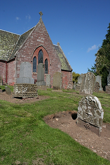
Image: © Anne Burgess Taken: 15 Aug 2010
The kirkyard slopes quite steeply down from the south gable, with a triple lancet window obviously inserted after the kirk was built. For detailed views of some of the old gravestones see Image], Image], Image] and Image'>Image
Images are licensed for reuse under creativecommons.org/licenses/by-sa/2.0
Image Location
Latitude
56.466498
Longitude
-3.190443