
IMAGES TAKEN NEAR TO
Mount Pleasant, PETERBOROUGH, PE2 8HW
Introduction
This page details the photographs taken nearby to Mount Pleasant, PE2 8HW by members of the Geograph project.
The Geograph project started in 2005 with the aim of publishing, organising and preserving representative images for every square kilometre of Great Britain, Ireland and the Isle of Man.

There are currently over 7.5m images from over14,400 individuals and you can help contribute to the project by visiting https://www.geograph.org.uk
Image Map
Images are licensed for reuse under creativecommons.org/licenses/by-sa/2.0
Notes
- Clicking on the map will re-center to the selected point.
- The higher the marker number, the further away the image location is from the centre of the postcode.
Image Listing (97 Images Found)
Images are licensed for reuse under creativecommons.org/licenses/by-sa/2.0
Image
Details
Distance
1
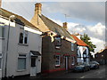
The Woolpack, Stanground
The Woolpack, a traditional local pub on North Street, dates from 1711. The garden leads to boat moorings on the Back River, which flows into the River Nene. Until the mid-19th. century, the barn to the rear of the pub served as the village mortuary. Stanground was originally a separate village but is now a residential suburb of Peterborough.
Source: https://whatpub.com/pubs/PET/282/woolpack-peterborough
Image: © Paul Bryan
Taken: 11 Oct 2014
0.06 miles
2
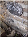
Roman stone child's coffin, Stanground
This stone child's coffin from the Roman era was uncovered during renovation work in February 1988. It is located in the beer garden of The Woolpack public house on North Street in Stanground.
Image: © Paul Bryan
Taken: 1 Apr 2017
0.06 miles
3
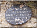
Surviving Medieval wall, Stanground
This remaining Medieval wall is located in the beer garden of The Woolpack public house on North Street in Stanground.
Image: © Paul Bryan
Taken: 1 Apr 2017
0.06 miles
4

Amusing notice at The Woolpack, Stanground
The landlord of The Woolpack on North Street in Stanground had been experiencing some difficulties with the residents of neighbouring properties following complaints about noise levels from live music performances at the pub. This sign in the beer garden amused my drinking companion and me anyway.
The Woolpack dates from 1711. The beer garden leads to boat moorings (reserved for use by pub customers only) on the Back River, a tributary of the River Nene. Until the mid-19th. century, the barn to the rear of the pub served as the village mortuary.
Sources: https://whatpub.com/pubs/PET/282/woolpack-peterborough
https://www.peterboroughtoday.co.uk/news/people/peterborough-landlord-devastated-after-being-forced-to-cut-back-live-music-following-council-order-3330008
Image: © Paul Bryan
Taken: 9 Oct 2021
0.06 miles
5

Barn to the rear of The Woolpack, Stanground
Until the mid-19th. century, this barn to the rear of The Woolpack on North Street in Stanground served as the village mortuary. The pub itself was built in 1711. The garden leads to boat moorings on the Back River, which flows into the River Nene. Stanground was originally a separate village but is now a residential suburb of Peterborough.
Source: https://whatpub.com/pubs/PET/282/woolpack-peterborough
Image: © Paul Bryan
Taken: 10 Jun 2017
0.07 miles
6
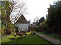
Beer garden of The Woolpack, Stanground
The Woolpack, a traditional local pub on North Street, dates from 1711. The Peterborough and District branch of the Campaign for Real Ale (CAMRA) voted The Woolpack as its Pub of the Year in 2016.
The beer garden leads to boat moorings (reserved for use by customers of the pub only) on the Back River, a tributary of the River Nene. Until the mid-19th. century, the barn to the rear of the pub - which can be seen in this image - served as the village mortuary.
Stanground was originally a separate village but is now a residential suburb of Peterborough.
Sources: https://whatpub.com/pubs/PET/282/woolpack-peterborough
https://www.peterboroughtoday.co.uk/news/woolpack-in-stanground-voted-peterborough-pub-of-the-year-by-camra-1-7209830
For an image of The Woolpack's exterior, please see: Image
Image: © Paul Bryan
Taken: 14 Apr 2018
0.07 miles
7

The Woolpack, Stanground
Looking east on North Street.
Image: © Dave Hitchborne
Taken: 22 Jun 2004
0.07 miles
8

Interior of St John the Baptist, Stanground
The sedilia, in the chancel.
Image: © Dave Hitchborne
Taken: 22 Jun 2004
0.08 miles
9

Interior of St John the Baptist, Stanground
The altar.
Image: © Dave Hitchborne
Taken: 22 Jun 2004
0.08 miles
10

Interior of St John the Baptist, Stanground
The altar cross.
Image: © Dave Hitchborne
Taken: 22 Jun 2004
0.08 miles