
Beer garden of The Woolpack, Stanground
Introduction
The photograph on this page of Beer garden of The Woolpack, Stanground by Paul Bryan as part of the Geograph project.
The Geograph project started in 2005 with the aim of publishing, organising and preserving representative images for every square kilometre of Great Britain, Ireland and the Isle of Man.

There are currently over 7.5m images from over 14,400 individuals and you can help contribute to the project by visiting https://www.geograph.org.uk
Beer garden of The Woolpack, Stanground
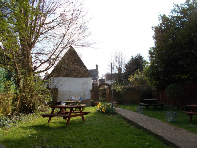
Image: © Paul Bryan Taken: 14 Apr 2018
The Woolpack, a traditional local pub on North Street, dates from 1711. The Peterborough and District branch of the Campaign for Real Ale (CAMRA) voted The Woolpack as its Pub of the Year in 2016. The beer garden leads to boat moorings (reserved for use by customers of the pub only) on the Back River, a tributary of the River Nene. Until the mid-19th. century, the barn to the rear of the pub - which can be seen in this image - served as the village mortuary. Stanground was originally a separate village but is now a residential suburb of Peterborough. Sources: https://whatpub.com/pubs/PET/282/woolpack-peterborough https://www.peterboroughtoday.co.uk/news/woolpack-in-stanground-voted-peterborough-pub-of-the-year-by-camra-1-7209830 For an image of The Woolpack's exterior, please see: Image
Images are licensed for reuse under creativecommons.org/licenses/by-sa/2.0
Image Location

Latitude
52.562418
Longitude
-0.227764