IMAGES TAKEN NEAR TO
Howe Hill, WATLINGTON, OX49 5HE
Introduction
This page details the photographs taken nearby to Howe Hill, OX49 5HE by members of the Geograph project.
The Geograph project started in 2005 with the aim of publishing, organising and preserving representative images for every square kilometre of Great Britain, Ireland and the Isle of Man.

There are currently over 7.5m images from over14,400 individuals and you can help contribute to the project by visiting https://www.geograph.org.uk
Image Map
Images are licensed for reuse under creativecommons.org/licenses/by-sa/2.0
Notes
- Clicking on the map will re-center to the selected point.
- The higher the marker number, the further away the image location is from the centre of the postcode.
Image Listing (19 Images Found)
Images are licensed for reuse under creativecommons.org/licenses/by-sa/2.0
Image
Details
Distance
1
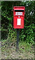
Elizabeth II postbox, Howe Hill
Postbox No. OX49 566.
See Image] for context.
Image: © JThomas
Taken: 25 May 2022
0.03 miles
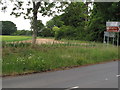
2
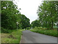
Howe Hill (B480)
Showing position of Postbox No. OX49 566.
See Image] for postbox.
Image: © JThomas
Taken: 25 May 2022
0.04 miles
3
Red Lane at the junction of Patemore Lane
Image: © David Howard
Taken: 12 Jun 2022
0.09 miles
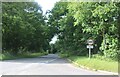
5
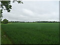
Side of B481 Red Lane and field beyond
This is the northern end of B481 at a junction with B480. The sign shows Watlington B480 to the right, Nettlebed B481 and via A4130 to Henley, towards the camera Christmas Cmn (Common), Pishill and Stonor. The brown tourist sign shows Stonor Park with a house symbol, Fox and Hounds with a cutlery symbol. There are flowers in the grassy verge, and wheat growing in the field.
Image: © David Hawgood
Taken: 8 Jun 2020
0.09 miles
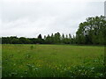
6
Brown Field Site
Some winter colours in the Chilterns.
Image: © Des Blenkinsopp
Taken: 20 Jan 2011
0.10 miles
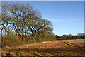
7
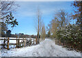
Snowy Track at Howe Hill
A light dusting of snow this morning brought out the usual crop of nice wintery scenes.
Image: © Des Blenkinsopp
Taken: 14 Dec 2022
0.11 miles
8
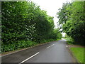
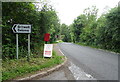
Nettlebed Henley
Minor road towards Greenfield.
Image: © JThomas
Taken: 25 May 2022
0.12 miles