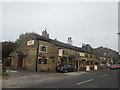
IMAGES TAKEN NEAR TO
Stonebreaks Road, OLDHAM, OL4 4BZ
Introduction
This page details the photographs taken nearby to Stonebreaks Road, OL4 4BZ by members of the Geograph project.
The Geograph project started in 2005 with the aim of publishing, organising and preserving representative images for every square kilometre of Great Britain, Ireland and the Isle of Man.

There are currently over 7.5m images from over14,400 individuals and you can help contribute to the project by visiting https://www.geograph.org.uk
Image Map
Images are licensed for reuse under creativecommons.org/licenses/by-sa/2.0
Notes
- Clicking on the map will re-center to the selected point.
- The higher the marker number, the further away the image location is from the centre of the postcode.
Image Listing (18 Images Found)
Images are licensed for reuse under creativecommons.org/licenses/by-sa/2.0
Image
Details
Distance
1

Woodbrook
The ford at Woodbrook on the ancient road from the Oldham area into Saddleworth.
Image: © Michael Fox
Taken: 11 Apr 2010
0.03 miles
2

Hillend spring
The hamlet of Hillend, near Woodbrook; Scouthead Church (St. Paul's) is in the distance.
Image: © Michael Fox
Taken: 11 Apr 2010
0.05 miles
3
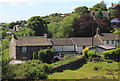
Woodbrook from the path to Pastures
The houses in the foreground mark the line of the old road from Saddleworth to Oldham as it climbs from a ford. In the left background is part of the even older hamlet of Stonebreaks.
Image: © Michael Fox
Taken: 3 Jun 2011
0.06 miles
4
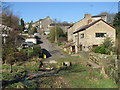
Woodbrook
The small hamlet of Woodbrook, near Springhead, lies at the bottom end of Woodbrook Road.
From here on after, when you have passed through the ford, the road turns into a green lane which is suitable only for four wheel drive vehicles.
Image: © Paul Anderson
Taken: 7 Feb 2007
0.08 miles
5
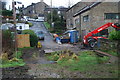
Ford on the Wood Brook
This ford on the Wood Brook is found at the end of Woodbrook Road where it meets Woodbrook Lane in Woodbrook.
Image: © John Walton
Taken: 19 Jan 2014
0.10 miles
6
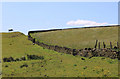
Old path from Pastures to Woodbrook
This is one of a large network of paths in Saddleworth that are likely to have originated as links between the many hamlets which once engaged in the home-based manufacture of textiles.
Image: © Michael Fox
Taken: 3 Jun 2011
0.15 miles
7
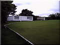
Springhead Cricket Club - Pavilion
The pavilion at Springead CC's ground off Mayfield Avenue.
The club run one team in the North Manchester Cricket League
Image: © BatAndBall
Taken: 13 Aug 2012
0.20 miles
8
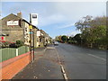
Bus stop on Huddersfield Road (A62)
Near the Three Crowns public house, Scouthead.
Image: © JThomas
Taken: 2 Nov 2018
0.20 miles
9
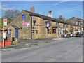
Three Crowns Inn
Pub/restaurant on Huddersfield Road (A62) at Austerlands.
Image: © David Dixon
Taken: 28 Oct 2011
0.21 miles