IMAGES TAKEN NEAR TO
Wimborne Drive, LONDON, NW9 9UB
Introduction
This page details the photographs taken nearby to Wimborne Drive, NW9 9UB by members of the Geograph project.
The Geograph project started in 2005 with the aim of publishing, organising and preserving representative images for every square kilometre of Great Britain, Ireland and the Isle of Man.

There are currently over 7.5m images from over14,400 individuals and you can help contribute to the project by visiting https://www.geograph.org.uk
Image Map
Images are licensed for reuse under creativecommons.org/licenses/by-sa/2.0
Notes
- Clicking on the map will re-center to the selected point.
- The higher the marker number, the further away the image location is from the centre of the postcode.
Image Listing (47 Images Found)
Images are licensed for reuse under creativecommons.org/licenses/by-sa/2.0
Image
Details
Distance
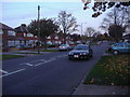
1
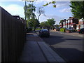
Wimborne Road, Kingsbury
A typical view of the local style of road and houses.
Image: © David Howard
Taken: 29 Apr 2009
0.03 miles
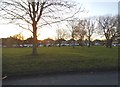
5
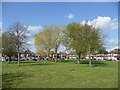
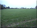
Sherborne Gardens, Queensbury
A pleasant patch of green space in an area of otherwise unrelenting brick and tarmac.
Image: © Jonathan Billinger
Taken: 8 Apr 2008
0.07 miles
7
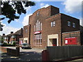
Queensbury Methodist Church
On the north side of Beverley Drive, the church was built in 1938 and its website is here http://www.barnetmethodist.co.uk/queensbury.htm
Image: © Nigel Cox
Taken: 18 May 2007
0.13 miles
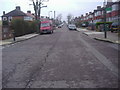
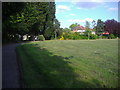
9
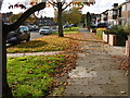
Autumn light along Beverley Drive
The name of Queensbury was the winner of a competition run by a Golders Green estate agent (Percy H Edwards) to come up with a title for the new district to the north of Kingsbury. Traffic on the railway grew only slowly, possibly because the Metropolitan charged main line fares. People found it cheaper to go to Edgware by bus and take the Hampstead Tube. Queensbury was the most rapidly- developed estate in north-west London. The landscape was largely flat and devoid of natural features.
For more about the station see http://www.geograph.org.uk/photo/4719174
The late October sun catches the leaves along the pavement of Beverley Drive in Queensbury.
Image: © Marathon
Taken: 28 Oct 2015
0.14 miles