IMAGES TAKEN NEAR TO
Princes Avenue, LONDON, NW9 9HY
Introduction
This page details the photographs taken nearby to Princes Avenue, NW9 9HY by members of the Geograph project.
The Geograph project started in 2005 with the aim of publishing, organising and preserving representative images for every square kilometre of Great Britain, Ireland and the Isle of Man.

There are currently over 7.5m images from over14,400 individuals and you can help contribute to the project by visiting https://www.geograph.org.uk
Image Map (35 Images)


Leaflet Map data © OpenStreetMap
Images are licensed for reuse under creativecommons.org/licenses/by-sa/2.0
Notes
- Clicking on the map will re-center to the selected point.
- The higher the marker number, the further away the image location is from the centre of the postcode.
Image Listing (35 Images Found)
Images are licensed for reuse under creativecommons.org/licenses/by-sa/2.0
Image
Details
Distance

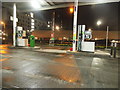
3
Capitol Way
This is within the largely commercial area to the west of Edgware Road.
Image: © Marathon
Taken: 28 Oct 2015
0.11 miles
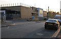
4
Stag Lane, Kingsbury
At the junction of Capitol Way
Image: © David Howard
Taken: 6 Mar 2022
0.12 miles
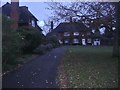
5
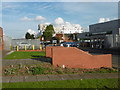
The Village School, Kingsbury
This is the side view from Grove Park
Image: © David Howard
Taken: 1 Apr 2019
0.14 miles