IMAGES TAKEN NEAR TO
Westmoreland Road, LONDON, NW9 9DZ
Introduction
This page details the photographs taken nearby to Westmoreland Road, NW9 9DZ by members of the Geograph project.
The Geograph project started in 2005 with the aim of publishing, organising and preserving representative images for every square kilometre of Great Britain, Ireland and the Isle of Man.

There are currently over 7.5m images from over14,400 individuals and you can help contribute to the project by visiting https://www.geograph.org.uk
Image Map
Images are licensed for reuse under creativecommons.org/licenses/by-sa/2.0
Notes
- Clicking on the map will re-center to the selected point.
- The higher the marker number, the further away the image location is from the centre of the postcode.
Image Listing (50 Images Found)
Images are licensed for reuse under creativecommons.org/licenses/by-sa/2.0
Image
Details
Distance
1
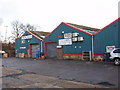
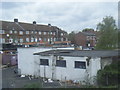
Bowman Trading Estate, Queensbury
On Westmoreland Road, just off Honeypot Lane. Businesses include plastics, kitchens, tyres, a carwash. A slate supplier is also in this road.
Image: © David Hawgood
Taken: 1 Jan 2006
0.01 miles
2
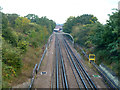
Jubilee Line between Queensbury and Kingsbury
A southbound train is coming round the bend, accelerating away from Queensbury.
Image: © Robin Webster
Taken: 13 Oct 2012
0.07 miles
5
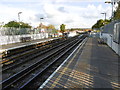
View south from Queensbury Underground station
The branch between Wembley Park and Stanmore was opened by the Metropolitan Railway in 1932. It was much harder to construct than anticipated and amongst the heavy works was the diversion of the Wealdstone Brook. Queensbury station opened on 16th December 1934, two years after the neighbouring stations. The name of Queensbury was the winner of a competition run by a Golders Green estate agent (Percy H Edwards) to come up with a title for the new district to the north of Kingsbury. Traffic on the railway grew only slowly, possibly because the Metropolitan charged main line fares. People found it cheaper to go to Edgware by bus and take the Hampstead Tube. Queensbury was the most rapidly- developed estate in north-west London. The landscape was largely flat and devoid of natural features.
The branch became part of the Bakerloo Line in 1939 when that line was extended from Baker Street to Finchley Road, from there taking over the Metropolitan's old slow tracks to Wembley Park before the Bakerloo continued to Stanmore. In 1979 it became part of the Jubilee Line to Charing Cross, and in 1999 was linked to Stratford by the Jubilee Line Extension.
This view is from the down platform, looking back towards Fryent Country Park on the skyline.
Image: © Marathon
Taken: 28 Oct 2015
0.14 miles

9
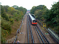
Jubilee Line between Queensbury and Kingsbury
A southbound train is composed of 1996 stock. This section was initially a branch of the Metropolitan Line and then the Bakerloo Line before the Jubilee Line came into being.
Image: © Robin Webster
Taken: 13 Oct 2012
0.16 miles