IMAGES TAKEN NEAR TO
Roe Green, LONDON, NW9 0PN
Introduction
This page details the photographs taken nearby to Roe Green, NW9 0PN by members of the Geograph project.
The Geograph project started in 2005 with the aim of publishing, organising and preserving representative images for every square kilometre of Great Britain, Ireland and the Isle of Man.

There are currently over 7.5m images from over14,400 individuals and you can help contribute to the project by visiting https://www.geograph.org.uk
Image Map
Images are licensed for reuse under creativecommons.org/licenses/by-sa/2.0
Notes
- Clicking on the map will re-center to the selected point.
- The higher the marker number, the further away the image location is from the centre of the postcode.
Image Listing (67 Images Found)
Images are licensed for reuse under creativecommons.org/licenses/by-sa/2.0
Image
Details
Distance
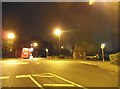
2
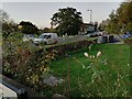
Roundabout between Stag Lane and Roe Green
Image: © David Howard
Taken: 15 Apr 2019
0.01 miles
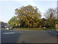
5
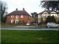
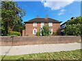
Kingsbury vicarage on Roe Green
It's on the left
Image: © David Howard
Taken: 15 Apr 2019
0.08 miles
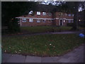
6
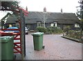
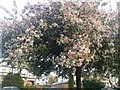
Thatched cottage on Stag Lane
There were a number of these built in Kingsbury, mainly by Trobridge, but as expected a few have since burnt down (including the one next to this) and were not replaced.
Image: © David Howard
Taken: 5 Nov 2014
0.08 miles