IMAGES TAKEN NEAR TO
Grove Park, LONDON, NW9 0LA
Introduction
This page details the photographs taken nearby to Grove Park, NW9 0LA by members of the Geograph project.
The Geograph project started in 2005 with the aim of publishing, organising and preserving representative images for every square kilometre of Great Britain, Ireland and the Isle of Man.

There are currently over 7.5m images from over14,400 individuals and you can help contribute to the project by visiting https://www.geograph.org.uk
Image Map
Images are licensed for reuse under creativecommons.org/licenses/by-sa/2.0
Notes
- Clicking on the map will re-center to the selected point.
- The higher the marker number, the further away the image location is from the centre of the postcode.
Image Listing (36 Images Found)
Images are licensed for reuse under creativecommons.org/licenses/by-sa/2.0
Image
Details
Distance
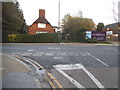
1
The Village School, Kingsbury
This is the side view from Grove Park
Image: © David Howard
Taken: 1 Apr 2019
0.06 miles
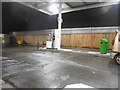
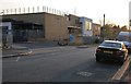
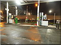
4
Asda petrol station and car park, Colindale
Image: © David Howard
Taken: 10 Dec 2015
0.15 miles
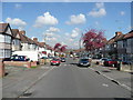
6
Goldsmith Lane at the junction of Stag Lane
Image: © David Howard
Taken: 5 Nov 2014
0.16 miles
7
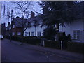
Rose Glen, Colindale
A piece of 1950's suburbia, not dissimilar to Image
Image: © Jonathan Billinger
Taken: 8 Apr 2008
0.16 miles
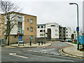
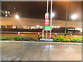
8
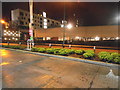
Asda petrol station and car park, Colindale
The flats opposite are almost finished.
Image: © David Howard
Taken: 11 Dec 2015
0.17 miles