
IMAGES TAKEN NEAR TO
Uphill Drive, LONDON, NW7 4RR
Introduction
This page details the photographs taken nearby to Uphill Drive, NW7 4RR by members of the Geograph project.
The Geograph project started in 2005 with the aim of publishing, organising and preserving representative images for every square kilometre of Great Britain, Ireland and the Isle of Man.

There are currently over 7.5m images from over14,400 individuals and you can help contribute to the project by visiting https://www.geograph.org.uk
Image Map
Images are licensed for reuse under creativecommons.org/licenses/by-sa/2.0
Notes
- Clicking on the map will re-center to the selected point.
- The higher the marker number, the further away the image location is from the centre of the postcode.
Image Listing (68 Images Found)
Images are licensed for reuse under creativecommons.org/licenses/by-sa/2.0
Image
Details
Distance
1
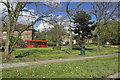
Grassland between Watford Way and Victoria Road, Mill Hill, NW7
Image: © MrC
Taken: 3 May 2010
0.05 miles
3
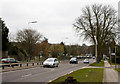
A1 Watford Way
Or... by another name, the Barnet By-Pass. This road was opened in 1928 and brought a boom in growth to the area.
The A1 and the A41 are merged along this section and will divide again just up the hill at Apex Corner.
Image: © Martin Addison
Taken: 10 Mar 2010
0.06 miles
4
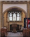
St Michael & All Angels, Flower Lane, Mill Hill - Baptistry
Image: © John Salmon
Taken: 17 Sep 2004
0.07 miles
5
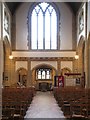
St Michael & All Angels, Flower Lane, Mill Hill - West end
Image: © John Salmon
Taken: 17 Sep 2004
0.07 miles
6
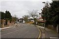
Weymouth Avenue
Looking along this quiet suburban street towards the busy A1 Watford Way.
Image: © Martin Addison
Taken: 10 Mar 2010
0.08 miles
8
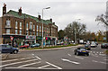
Mill Hill Circus
Looking across the circus towards Clarence Court which is a mix of apartments and shops. On the right, northbound traffic heads up the A1 Watford Way towards the infamous Apex Corner. The Broadway is the road on the left.
Image: © Martin Addison
Taken: 10 Mar 2010
0.13 miles
9
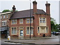
125-127 The Broadway
Former Bank.
Image: © Oast House Archive
Taken: 6 Jun 2017
0.14 miles
10
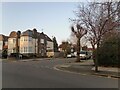
Mill Way at the junction of Newcombe Park
Image: © David Howard
Taken: 2 Mar 2021
0.15 miles