
IMAGES TAKEN NEAR TO
Beech Walk, LONDON, NW7 3PH
Introduction
This page details the photographs taken nearby to Beech Walk, NW7 3PH by members of the Geograph project.
The Geograph project started in 2005 with the aim of publishing, organising and preserving representative images for every square kilometre of Great Britain, Ireland and the Isle of Man.

There are currently over 7.5m images from over14,400 individuals and you can help contribute to the project by visiting https://www.geograph.org.uk
Image Map
Images are licensed for reuse under creativecommons.org/licenses/by-sa/2.0
Notes
- Clicking on the map will re-center to the selected point.
- The higher the marker number, the further away the image location is from the centre of the postcode.
Image Listing (94 Images Found)
Images are licensed for reuse under creativecommons.org/licenses/by-sa/2.0
Image
Details
Distance
3
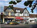
Shopping Parade at Mill Hill
This is a typical suburban group of shops with others on the opposite side of the road. To make shopping a nightmare
Image: © Jack Hill
Taken: 29 Jul 2005
0.08 miles
5
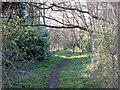
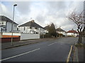
The course of the former Mill Hill East to Edgware railway line near The Meads
See Image The section of the former line from here as far as Dean's Lane is now the Mill Hill Old Railway Nature Reserve. In happier, pre Covid-19 times, it was open 10am-4pm on Saturdays and Sundays. As you can see from my photos of the rest of the former railway line west of Bunn's Lane https://www.geograph.org.uk/search.php?i=112315803 all of it is effectively a nature reserve.
Image: © Mike Quinn
Taken: 26 Feb 2020
0.10 miles
8
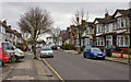
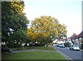
Hale Grove Gardens
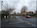
Seen close to and looking towards the junction with Hale Lane.
Image: © Martin Addison
Taken: 10 Mar 2010
0.12 miles
10
The Meads
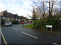
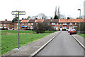
The Meads forms part of the Watling Estate built on land that used to be Goldbeaters Farm between 1924 and 1930. The estate was designed by George Forrest. The line of the housing around a central open space closely follows a pre-existing field boundary and the development may have taken its name from the use of that field as a hay meadow. The open grass in the centre of the estate is split by the course of Burnt Oak Brook. The sign in the foreground indicates the course of the Barnet Millennium Walk, a circular walk of 4 miles from Mill Hill Broadway station through Lyndhurst Park, Watling Park, Silk Stream Park, Montrose Playing Fields, Grahame Park and Woodcroft Park.
Image: © Martin Addison
Taken: 25 Feb 2011
0.12 miles