The Meads
Introduction
The photograph on this page of The Meads by Martin Addison as part of the Geograph project.
The Geograph project started in 2005 with the aim of publishing, organising and preserving representative images for every square kilometre of Great Britain, Ireland and the Isle of Man.

There are currently over 7.5m images from over 14,400 individuals and you can help contribute to the project by visiting https://www.geograph.org.uk
The Meads
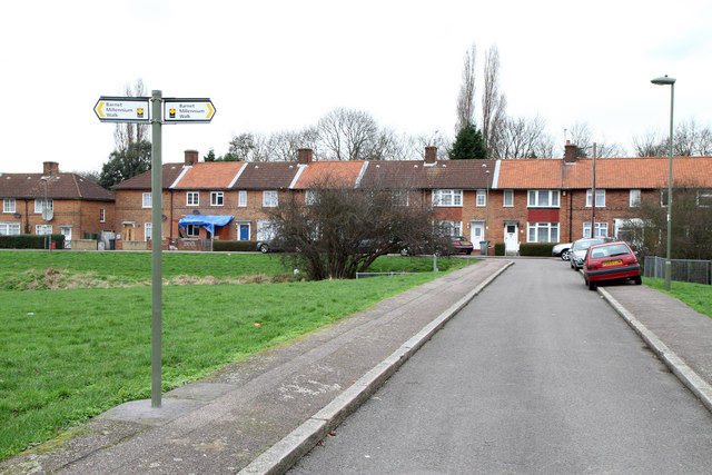
Image: © Martin Addison Taken: 25 Feb 2011
The Meads forms part of the Watling Estate built on land that used to be Goldbeaters Farm between 1924 and 1930. The estate was designed by George Forrest. The line of the housing around a central open space closely follows a pre-existing field boundary and the development may have taken its name from the use of that field as a hay meadow. The open grass in the centre of the estate is split by the course of Burnt Oak Brook. The sign in the foreground indicates the course of the Barnet Millennium Walk, a circular walk of 4 miles from Mill Hill Broadway station through Lyndhurst Park, Watling Park, Silk Stream Park, Montrose Playing Fields, Grahame Park and Woodcroft Park.
Images are licensed for reuse under creativecommons.org/licenses/by-sa/2.0
Image Location
Latitude
51.612122
Longitude
-0.25361