IMAGES TAKEN NEAR TO
Page Street, LONDON, NW7 2EE
Introduction
This page details the photographs taken nearby to Page Street, NW7 2EE by members of the Geograph project.
The Geograph project started in 2005 with the aim of publishing, organising and preserving representative images for every square kilometre of Great Britain, Ireland and the Isle of Man.

There are currently over 7.5m images from over14,400 individuals and you can help contribute to the project by visiting https://www.geograph.org.uk
Image Map
Images are licensed for reuse under creativecommons.org/licenses/by-sa/2.0
Notes
- Clicking on the map will re-center to the selected point.
- The higher the marker number, the further away the image location is from the centre of the postcode.
Image Listing (50 Images Found)
Images are licensed for reuse under creativecommons.org/licenses/by-sa/2.0
Image
Details
Distance
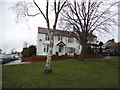
2
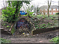
Blocked pedestrian subway under Page Street
Image: © Mike Quinn
Taken: 26 Feb 2020
0.04 miles
3
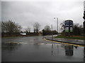
The entrance to Copthall Centre, Allianz Park
Allianz Insurance now sponsor the centre.
Image: © David Howard
Taken: 28 Feb 2017
0.04 miles
4
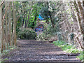
The course of the former Mill Hill East to Edgware railway line east of Page Street (7)
Image: © Mike Quinn
Taken: 26 Feb 2020
0.04 miles
5
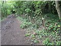
Old Railway Footpath
This footpath that now occupies the land that used to follow a railway extension between Mill Hill East and Edgware. It was proposed to electrify this line and incorporate it as part of the Northern line - evidence of this remains and can be seen in the form of traction power cable posts. Work started on this but was interrupted by the Second World War and never completed.
Image: © Hywel Williams
Taken: 1 May 2005
0.05 miles
6
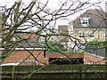
Houses in Bampton Drive, NW7
Photo taken from Page Street, immediately above the western end of the Image looking along the course of the former Mill Hill East to Edgware railway line - see Image This relatively recent housing development, which stretches for about 500 m to the A1, would make re-instatement of the line mildly problematical - see https://goo.gl/maps/iJ9tdaH2Myq7jMAD9 .
Image: © Mike Quinn
Taken: 26 Feb 2020
0.05 miles
7
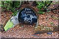
Jesus Loves You
Sealed off subway under Page Street. This is on the route of the line from Mill Hill East to Edgware but it certainly isn't the original bridge that the railway passed under. Presumably built when the housing estate on the opposite side of the road was built, I suspect that the roof of this structure has become dangerous. The cracked brickwork at the top of the arch hints as much.
Image: © Martin Addison
Taken: 19 Jan 2009
0.06 miles
8
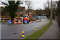
Page Street
Roadworks hold up the traffic on this busy street.
Image: © Martin Addison
Taken: 19 Jan 2009
0.07 miles
9

Beyond Mill Hill East
The Page Street end of the route. Barriers have been installed to discourage the joyriding of motorcycles. Beyond, is a subway under the road rather than the bridge that must have existed in the past. Older maps show the railway as being in a cutting at this point, so a certain amount of landfill seems to have taken place. Beyond Page Street the route of the railway has disappeared under a housing estate.
Image: © Martin Addison
Taken: 19 Jan 2009
0.08 miles