Old Railway Footpath
Introduction
The photograph on this page of Old Railway Footpath by Hywel Williams as part of the Geograph project.
The Geograph project started in 2005 with the aim of publishing, organising and preserving representative images for every square kilometre of Great Britain, Ireland and the Isle of Man.

There are currently over 7.5m images from over 14,400 individuals and you can help contribute to the project by visiting https://www.geograph.org.uk
Old Railway Footpath
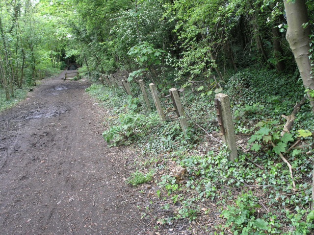
Image: © Hywel Williams Taken: 1 May 2005
This footpath that now occupies the land that used to follow a railway extension between Mill Hill East and Edgware. It was proposed to electrify this line and incorporate it as part of the Northern line - evidence of this remains and can be seen in the form of traction power cable posts. Work started on this but was interrupted by the Second World War and never completed.
Images are licensed for reuse under creativecommons.org/licenses/by-sa/2.0
Image Location


Leaflet Map data © OpenStreetMap
Latitude
51.605422
Longitude
-0.232494