
IMAGES TAKEN NEAR TO
Lamble Street, LONDON, NW5 4AS
Introduction
This page details the photographs taken nearby to Lamble Street, NW5 4AS by members of the Geograph project.
The Geograph project started in 2005 with the aim of publishing, organising and preserving representative images for every square kilometre of Great Britain, Ireland and the Isle of Man.

There are currently over 7.5m images from over14,400 individuals and you can help contribute to the project by visiting https://www.geograph.org.uk
Image Map
Images are licensed for reuse under creativecommons.org/licenses/by-sa/2.0
Notes
- Clicking on the map will re-center to the selected point.
- The higher the marker number, the further away the image location is from the centre of the postcode.
Image Listing (246 Images Found)
Images are licensed for reuse under creativecommons.org/licenses/by-sa/2.0
Image
Details
Distance
1
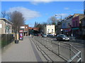
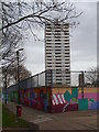
Mansfield Road, NW3 (1)
Looking towards Gospel Oak station, facing ENE. For most of the length of this road it is the boundary between NW3 and NW5 Postal Districts.
Image: © Danny P Robinson
Taken: 19 Mar 2006
0.04 miles
2
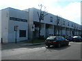
Mansfield Road, NW3 (2)
Corner of Oak Village, NW5.
Image: © Danny P Robinson
Taken: 19 Mar 2006
0.04 miles
4
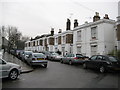
Gospel Oak: Elaine Grove, NW5
This road contains one of the surviving sections of mid-Victorian houses on the once much larger Lismore Circus estate. Curiously the 1874 edition of the Ordnance Survey mapping clearly describes the road as Arthur Grove. By the time that the 1896 edition was published it had acquired its present day name. One wonders what was wrong with Arthur.
Post script. In 1876 the Metropolitan Board of Works decreed the change, noting that the irregularly numbered houses should be renumbered, so maybe it was an attempt to tidy up the street entirely.
Image: © Nigel Cox
Taken: 14 Feb 2010
0.05 miles
6
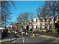
Grafton Road, Gospel Oak
At certain times of day, Grafton Road is closed to through traffic to reduce 'rat running'. The road sign in the middle of the image can change to show 'no entry'. The road has a width restriction to prevent large vehicles from using it.
Image: © Malc McDonald
Taken: 7 Mar 2015
0.05 miles
7
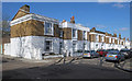
Elaine Grove, Gospel Oak
The description to Image] tells us more about Elaine Grove.
Image: © Jim Osley
Taken: 25 Mar 2016
0.05 miles

9

Parade of shops on Mansfield Road, Gospel Oak
Image: © David Howard
Taken: 28 Apr 2020
0.07 miles
