1
St Martin, Vicars Road, Gospel Oak - Organ
Image: © John Salmon
Taken: 18 Sep 2011
0.04 miles
2
Kentish Town City Farm
Kentish Town City Farm was formed in 1972 becoming the first City Farm to be established in the United Kingdom. It is surrounded by railways with the lines out of St Pancras, as well as London Overground. Two of the farm's pigs are on the left here.
Full details can be seen on the farm's website - ktcityfarm.org.uk
Image: © Marathon
Taken: 27 Apr 2023
0.04 miles
3
Kentish Town City Farm
Kentish Town City Farm was formed in 1972 becoming the first City Farm to be established in the United Kingdom. It is surrounded by railways with the lines out of St Pancras, as well as London Overground which can be seen here with a freight train passing.
Full details can be seen on the farm's website - ktcityfarm.org.uk
Image: © Marathon
Taken: 27 Apr 2023
0.05 miles
4
Engineering Works at Carlton Road Junction
Engineers trains stand on the mainline into St Pancras as extensive track renewal is carried out to the west of Kentish Town station. The extent of the work being carried out required the closure of St Pancras as well as the Thameslink route. As a result all services from the north were terminating at West Hampstead over the weekend of 31st January / 1st February 2015.
The tracks diverging in the foreground at Carlton Road Junction lead up to Junction Road Junction and connect there with the line to Barking. The houses on the right are on Dale Road - a very short cul-de-sac.
Image: © Martin Addison
Taken: 31 Jan 2015
0.07 miles
5
Railway lines near Oak Village, NW5
Image: © Mike Quinn
Taken: 7 Aug 2009
0.08 miles
6
Kentish Town City Farm
Kentish Town City Farm was formed in 1972 becoming the first City Farm to be established in the United Kingdom. It is surrounded by railways with the lines out of St Pancras seen here, as well as London Overground.
Full details can be seen on the farm's website - ktcityfarm.org.uk
Image: © Marathon
Taken: 27 Apr 2023
0.08 miles
7
Kentish Town City Farm
Kentish Town City Farm was formed in 1972 becoming the first City Farm to be established in the United Kingdom. It is surrounded by railways with the lines out of St Pancras, as seen here, as well as London Overground.
Full details can be seen on the farm's website - ktcityfarm.org.uk
Image: © Marathon
Taken: 27 Apr 2023
0.08 miles
8
Kentish Town City Farm
Kentish Town City Farm was formed in 1972 becoming the first City Farm to be established in the United Kingdom. It is surrounded by railways with the lines out of St Pancras, where a Thameslink train can be seen here, as well as London Overground.
Full details can be seen on the farm's website - ktcityfarm.org.uk
Image: © Marathon
Taken: 27 Apr 2023
0.08 miles
9
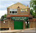
Entrance, Kentish Town City Farm
Image: © Jim Osley
Taken: 22 May 2016
0.09 miles
10
Railways near Grafton Road
As seen from Grafton Road Bridge, looking eastwards.
The lines on the left lead to Upper Holloway station (on the Gospel Oak to Barking line).
The lines on the right are part of the London Underground network (on the Northern Line) leading towards Kentish Town.
They both pass under bridges carrying the North London Line (NLL).
The white house on the right is on the very short Dale Close.
Image: © David Anstiss
Taken: 15 Aug 2017
0.10 miles


