
IMAGES TAKEN NEAR TO
Chetwynd Villas, Chetwynd Road, LONDON, NW5 1BT
Introduction
This page details the photographs taken nearby to Chetwynd Villas, Chetwynd Road, NW5 1BT by members of the Geograph project.
The Geograph project started in 2005 with the aim of publishing, organising and preserving representative images for every square kilometre of Great Britain, Ireland and the Isle of Man.

There are currently over 7.5m images from over14,400 individuals and you can help contribute to the project by visiting https://www.geograph.org.uk
Image Map
Images are licensed for reuse under creativecommons.org/licenses/by-sa/2.0
Notes
- Clicking on the map will re-center to the selected point.
- The higher the marker number, the further away the image location is from the centre of the postcode.
Image Listing (185 Images Found)
Images are licensed for reuse under creativecommons.org/licenses/by-sa/2.0
Image
Details
Distance
1
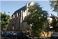
View of Highgate Road Chapel from Chetwynd Road
Looking southeast.
Image: © Robert Lamb
Taken: 21 Sep 2019
0.03 miles
2
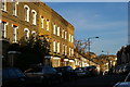
Chetwynd Road, Kentish Town
Hulking on the horizon, the church of St Mary Brookfield on Dartmouth Park Hill.
Image: © Christopher Hilton
Taken: 19 Jan 2017
0.03 miles
3
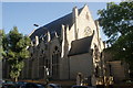
View of Highgate Road Chapel from Chetwynd Road #2
Looking southeast.
Image: © Robert Lamb
Taken: 21 Sep 2019
0.03 miles
4
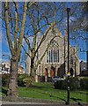
Highgate Road Baptist Chapel
Built in 1877 to the designs of architects F.C. Satchell and R.C. Edwards. (Ref: The Building of England. London 4: North (1998), p. 351). Partly converted into residential accommodation.
Image: © Jim Osley
Taken: 25 Mar 2016
0.04 miles
5
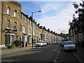
Dartmouth Park: Chetwynd Road, NW5
Old Ordnance Survey maps show that Chetwynd Road, and its branch off to the south, Twisden Road, did not exist before 1872 but were complete by 1895. They were built over what appears on the map to have been the formal gardens of a large house, and post-date the housing on Dartmouth Park Road to the north.
Image: © Nigel Cox
Taken: 30 Jul 2006
0.04 miles
7
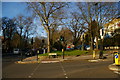
Green space along Highgate Road, Kentish Town
Image: © Christopher Hilton
Taken: 19 Jan 2017
0.04 miles
8
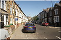
View up the hill on Chetwynd Road
Looking northeast.
Image: © Robert Lamb
Taken: 21 Sep 2019
0.05 miles
9
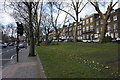
Highgate Enclosures
An area of common land on both sides of Highgate Road, maintained as public park.
Image: © Bill Boaden
Taken: 16 Mar 2016
0.06 miles
10
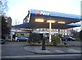
Pace garage on Highgate Road
The petrol, like the nearby one on Haverstock Hill was 1.47 a litre, 18p above the local average. They clearly make plenty from the car servicing but why would anyone buy petrol there when they can get it for far less down the road in Chalk Farm?
Image: © David Howard
Taken: 7 Mar 2014
0.06 miles