IMAGES TAKEN NEAR TO
Lyndale Avenue, LONDON, NW2 2QB
Introduction
This page details the photographs taken nearby to Lyndale Avenue, NW2 2QB by members of the Geograph project.
The Geograph project started in 2005 with the aim of publishing, organising and preserving representative images for every square kilometre of Great Britain, Ireland and the Isle of Man.

There are currently over 7.5m images from over14,400 individuals and you can help contribute to the project by visiting https://www.geograph.org.uk
Image Map
Images are licensed for reuse under creativecommons.org/licenses/by-sa/2.0
Notes
- Clicking on the map will re-center to the selected point.
- The higher the marker number, the further away the image location is from the centre of the postcode.
Image Listing (135 Images Found)
Images are licensed for reuse under creativecommons.org/licenses/by-sa/2.0
Image
Details
Distance
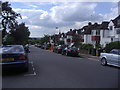
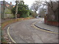
1
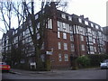
Wendover Court on Lyndale Avenue, Cricklewood
Image: © David Howard
Taken: 28 Jan 2010
0.04 miles
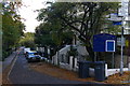
2
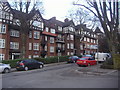
Moreland Court on Lyndale, Cricklewood
Image: © David Howard
Taken: 28 Jan 2010
0.04 miles
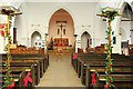
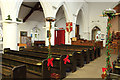
4
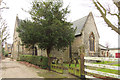
Church Walk, NW2
As the signs indicate, down Church Walk is the church of All Saints.
Image: © Christopher Hilton
Taken: 7 Nov 2016
0.06 miles