IMAGES TAKEN NEAR TO
Hendon Way, LONDON, NW2 2NG
Introduction
This page details the photographs taken nearby to Hendon Way, NW2 2NG by members of the Geograph project.
The Geograph project started in 2005 with the aim of publishing, organising and preserving representative images for every square kilometre of Great Britain, Ireland and the Isle of Man.

There are currently over 7.5m images from over14,400 individuals and you can help contribute to the project by visiting https://www.geograph.org.uk
Image Map
Images are licensed for reuse under creativecommons.org/licenses/by-sa/2.0
Notes
- Clicking on the map will re-center to the selected point.
- The higher the marker number, the further away the image location is from the centre of the postcode.
Image Listing (40 Images Found)
Images are licensed for reuse under creativecommons.org/licenses/by-sa/2.0
Image
Details
Distance
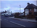
1
The Vale at the junction of Hendon Way
Image: © David Howard
Taken: 28 Oct 2020
0.11 miles
2
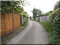
The entrance to allotments on Garth Road
Image: © David Howard
Taken: 31 May 2014
0.12 miles
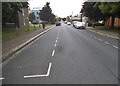
4
The Vale, Cricklewood
At junction of Hendon Way
Image: © David Howard
Taken: 20 Jan 2011
0.12 miles
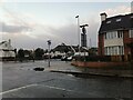
5
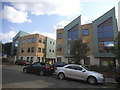
Business park on Granville Road, Childs Hill
Image: © David Howard
Taken: 21 Jul 2017
0.13 miles
7
Industrial estate and blocks of flats, Granville Road, NW2
Image: © Christopher Hilton
Taken: 7 Nov 2016
0.14 miles
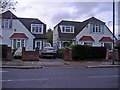
8
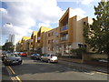
New flats on Granville Road, Childs Hill
Image: © David Howard
Taken: 21 Jul 2017
0.14 miles
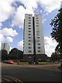
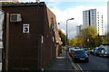
9
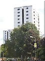
Tower blocks on Granville Road, Childs Hill
Image: © David Howard
Taken: 21 Jul 2017
0.14 miles