
IMAGES TAKEN NEAR TO
Churchway, LONDON, NW1 1LS
Introduction
This page details the photographs taken nearby to Churchway, NW1 1LS by members of the Geograph project.
The Geograph project started in 2005 with the aim of publishing, organising and preserving representative images for every square kilometre of Great Britain, Ireland and the Isle of Man.

There are currently over 7.5m images from over14,400 individuals and you can help contribute to the project by visiting https://www.geograph.org.uk
Image Map
Images are licensed for reuse under creativecommons.org/licenses/by-sa/2.0
Notes
- Clicking on the map will re-center to the selected point.
- The higher the marker number, the further away the image location is from the centre of the postcode.
Image Listing (2016 Images Found)
Images are licensed for reuse under creativecommons.org/licenses/by-sa/2.0
Image
Details
Distance
3
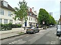
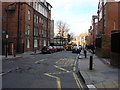
Charlton Street and the Somers Town Coffee Shop
A quiet street behind Euston Station
Image: © Bikeboy
Taken: 27 Apr 2024
0.02 miles
4
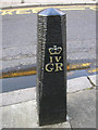
King George IV Bollard on the Pavement of Doric Way, London NW1
Image: © Robin Sones
Taken: 4 Jul 2006
0.03 miles
5
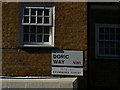
Doric Way, formerly Drummond Street
A sign on the street corner. The new name for the street presumably comes from the (now long vanished) Doric Arch at Euston Image
Image: © Stephen Craven
Taken: 27 Sep 2018
0.03 miles
6
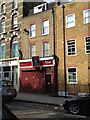
59 Chalton Street NW1
This humble building on the west side of Chalton Street is believed to be the former London premises of E & A Ashworth Ltd, weighing machine and weighbridge manufacturers of Dewsbury and London. In the early 1960s when I worked there for a year or so, the paintwork was grey, there was a front door and roller shutter doors to a workshop or garage. The domestic rooms on the upper floors served as offices and stores. At the time of the photograph the occupier was or had recently been Tahani Events.
Image: © Robin Stott
Taken: 10 Jun 2012
0.03 miles
7
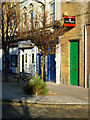
Churchway, Somers Town
A row of shops, entrances to flats and other commercial premises at the north end of Churchway, opposite Doric Way.
Image: © Stephen McKay
Taken: 9 Jan 2009
0.03 miles
8
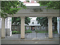
Levita House, entrance from Chalton Street
The columns and architrave have a neo-classical flavour, characteristic of the times. There may have been a sign above the central opening, or it's illegible. The columns are catching reflected light from warm brick buildings on the other side of Chalton Street. The entrance itself is heavily shaded by dense-foliaged hornbeams Image The elegant gates are believed to be a more recent addition: part of the refurbishment of Levita House. Other views of it, from Ossulston Street, are Image and Image
Image: © Robin Stott
Taken: 10 Jun 2012
0.03 miles
9

Churchway NW1
Churchway here is a passage between Chalton Street and the junction of Drummond Crescent and Doric Way. Churchway continues south as a road, A4200 in part, to meet the Euston Road. Just visible ahead in Chalton Street is the Somers Town Coffee House Image, built as part of the Ossulston Estate. The house on the right is signed: Somers Town Islamic Cultural and Education Centre.
Image: © Robin Stott
Taken: 10 Jun 2012
0.03 miles
10
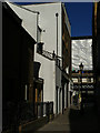
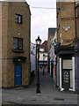
Alleyway from Church Way to Chalton Street
This alley is shown (unnamed) on the 1895 OS map. I can imagine Charles Dickens, or William Booth, walking this way.
Image: © Stephen Craven
Taken: 27 Sep 2018
0.03 miles