Churchway NW1
Introduction
The photograph on this page of Churchway NW1 by Robin Stott as part of the Geograph project.
The Geograph project started in 2005 with the aim of publishing, organising and preserving representative images for every square kilometre of Great Britain, Ireland and the Isle of Man.

There are currently over 7.5m images from over 14,400 individuals and you can help contribute to the project by visiting https://www.geograph.org.uk
Churchway NW1
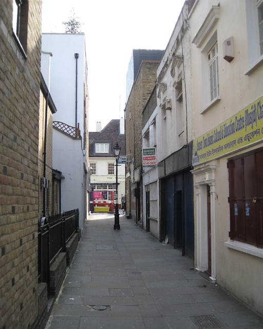
Image: © Robin Stott Taken: 10 Jun 2012
Churchway here is a passage between Chalton Street and the junction of Drummond Crescent and Doric Way. Churchway continues south as a road, A4200 in part, to meet the Euston Road. Just visible ahead in Chalton Street is the Somers Town Coffee House Image, built as part of the Ossulston Estate. The house on the right is signed: Somers Town Islamic Cultural and Education Centre.
Images are licensed for reuse under creativecommons.org/licenses/by-sa/2.0
Image Location
Latitude
51.529745
Longitude
-0.130614