IMAGES TAKEN NEAR TO
Woodstock Avenue, LONDON, NW11 9SL
Introduction
This page details the photographs taken nearby to Woodstock Avenue, NW11 9SL by members of the Geograph project.
The Geograph project started in 2005 with the aim of publishing, organising and preserving representative images for every square kilometre of Great Britain, Ireland and the Isle of Man.

There are currently over 7.5m images from over14,400 individuals and you can help contribute to the project by visiting https://www.geograph.org.uk
Image Map (Loading...)


Getting Data...Please wait
Leaflet Map data © OpenStreetMap
Images are licensed for reuse under creativecommons.org/licenses/by-sa/2.0
Notes
- Clicking on the map will re-center to the selected point.
- The higher the marker number, the further away the image location is from the centre of the postcode.
Image Listing (173 Images Found)
Images are licensed for reuse under creativecommons.org/licenses/by-sa/2.0
Image
Details
Distance
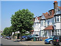
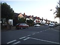
1
Woodstock Road, Golders Green
Corner of The Grove, looking towards Golders Green Road
Image: © David Howard
Taken: 27 May 2015
0.03 miles
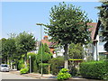
2
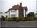
House on the corner of The Drive, Golders Green
Image: © David Howard
Taken: 27 May 2015
0.04 miles
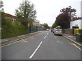
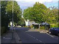
5
Woodstock Road at the junction of The Drive
Image: © David Howard
Taken: 24 Sep 2014
0.05 miles
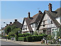
6
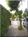
Bendy tree on The Grove
This is the standard variety for the area (a London plane I think) and has had one branch removed to keep it out of the road.
Image: © David Howard
Taken: 27 May 2015
0.05 miles
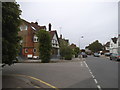
7
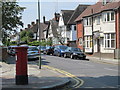
Woodstock Avenue, NW11
Shows the location of Image
Image: © Mike Quinn
Taken: 3 Aug 2011
0.05 miles