IMAGES TAKEN NEAR TO
Armitage Road, LONDON, NW11 8QT
Introduction
This page details the photographs taken nearby to Armitage Road, NW11 8QT by members of the Geograph project.
The Geograph project started in 2005 with the aim of publishing, organising and preserving representative images for every square kilometre of Great Britain, Ireland and the Isle of Man.

There are currently over 7.5m images from over14,400 individuals and you can help contribute to the project by visiting https://www.geograph.org.uk
Image Map
Images are licensed for reuse under creativecommons.org/licenses/by-sa/2.0
Notes
- Clicking on the map will re-center to the selected point.
- The higher the marker number, the further away the image location is from the centre of the postcode.
Image Listing (50 Images Found)
Images are licensed for reuse under creativecommons.org/licenses/by-sa/2.0
Image
Details
Distance
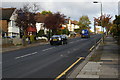
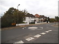
2
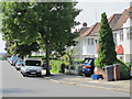
Houses on Armitage Road, Golders Green
Image: © Christopher Hilton
Taken: 7 Nov 2016
0.08 miles
3
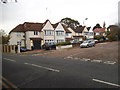
Basing Hill at the junction of Wayside
Image: © David Howard
Taken: 24 Oct 2014
0.09 miles
4
Basing Hill Park
The area where Basing Hill Park is now was open fields until the 1920s, when it was developed for housing. In 1936 the ground was laid out as a park to serve the local people. Details and a little more history is given at http://www.londongardensonline.org.uk/gardens-online-record.asp?ID=BAR005
This view looks from the park across Wayside to the houses in Basing Hill.
Image: © Marathon
Taken: 4 Mar 2015
0.11 miles
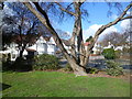
6
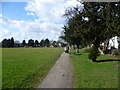
Path along the edge of Basing Hill Park
The area where Basing Hill Park is now was open fields until the 1920s, when it was developed for housing. In 1936 the ground was laid out as a park to serve the local people. Details and a little more history is given at http://www.londongardensonline.org.uk/gardens-online-record.asp?ID=BAR005
This view looks along the edge of the park with Wayside to the right.
Image: © Marathon
Taken: 4 Mar 2015
0.11 miles
7
Entrance to Basing Hill Park
The area where Basing Hill Park is now was open fields until the 1920s, when it was developed for housing. In 1936 the ground was laid out as a park to serve the local people. Details and a little more history is given at http://www.londongardensonline.org.uk/gardens-online-record.asp?ID=BAR005
This view looks from one of the park entrances across Wayside to the houses in Armitage Road.
Image: © Marathon
Taken: 4 Mar 2015
0.12 miles
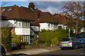
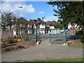
8
Gresham Gardens
One of a grid of residential streets located on a gentle slope between Golders Green Road and the Hendon Way.
Image: © Martin Addison
Taken: 28 May 2010
0.12 miles
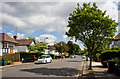
9
Wayside at the junction of Armitage Road
Image: © David Howard
Taken: 24 Oct 2014
0.12 miles
10
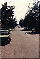
The Vale in 1989
I have always liked straight roads and taken photos of any I find
Image: © David Howard
Taken: Unknown
0.12 miles