IMAGES TAKEN NEAR TO
Hill Top, LONDON, NW11 6DY
Introduction
This page details the photographs taken nearby to Hill Top, NW11 6DY by members of the Geograph project.
The Geograph project started in 2005 with the aim of publishing, organising and preserving representative images for every square kilometre of Great Britain, Ireland and the Isle of Man.

There are currently over 7.5m images from over14,400 individuals and you can help contribute to the project by visiting https://www.geograph.org.uk
Image Map
Images are licensed for reuse under creativecommons.org/licenses/by-sa/2.0
Notes
- Clicking on the map will re-center to the selected point.
- The higher the marker number, the further away the image location is from the centre of the postcode.
Image Listing (104 Images Found)
Images are licensed for reuse under creativecommons.org/licenses/by-sa/2.0
Image
Details
Distance
4
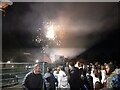
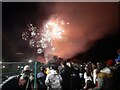
Fireworks at Brookland Primary School, Hampstead Garden Suburb
I was at the school from 1965-69
Image: © David Howard
Taken: 11 Nov 2023
0.08 miles
5
Fireworks at Brookland Primary School, Hampstead Garden Suburb
Where I was between 1965 and 1969
Image: © David Howard
Taken: 11 Nov 2023
0.09 miles
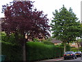
7
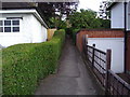
Path from Brookland Hill to Hutchings Walk
Image: © David Howard
Taken: 30 Jun 2006
0.09 miles
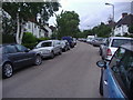
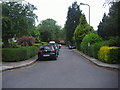
9
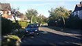
Brookland Rise, Hampstead Garden Suburb
Image: © David Howard
Taken: 26 Aug 2016
0.10 miles
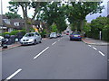
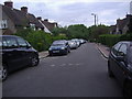
10
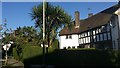
Houses on Brookland Rise, Hampstead Garden Suburb
Image: © David Howard
Taken: 26 Aug 2016
0.11 miles