
IMAGES TAKEN NEAR TO
Beckett Close, LONDON, NW10 9BS
Introduction
This page details the photographs taken nearby to Beckett Close, NW10 9BS by members of the Geograph project.
The Geograph project started in 2005 with the aim of publishing, organising and preserving representative images for every square kilometre of Great Britain, Ireland and the Isle of Man.

There are currently over 7.5m images from over14,400 individuals and you can help contribute to the project by visiting https://www.geograph.org.uk
Image Map
Images are licensed for reuse under creativecommons.org/licenses/by-sa/2.0
Notes
- Clicking on the map will re-center to the selected point.
- The higher the marker number, the further away the image location is from the centre of the postcode.
Image Listing (100 Images Found)
Images are licensed for reuse under creativecommons.org/licenses/by-sa/2.0
Image
Details
Distance

3
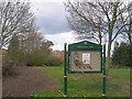
Entrance to Brentfield Park, Leicester Road, NW10
Image: © Robin Sones
Taken: 27 Mar 2009
0.07 miles
4
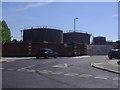
Gas holders on Gibbons Road, Harlesden
At the junction of Bridge Road, the bridge is just out of shot on the left carrying the railway.
Image: © David Howard
Taken: 24 Jun 2009
0.07 miles
5
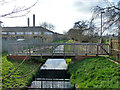
Canal feeder by Gibbons Recreation Ground
The footbridge running to a deck by the feeder appears to be for educational purposes - a path from it runs across the recreation ground to the local primary school.
Image: © Robin Webster
Taken: 12 Feb 2011
0.07 miles
6
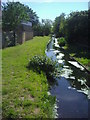
Canal feeder
This starts at the Welsh Harp reservoir and joins the Grand Union Canal further south.
Image: © David Howard
Taken: 24 Jun 2009
0.08 miles

8
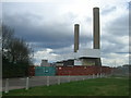
Taylor's Lane Power Station, Leicester Road, NW11
Image: © Robin Sones
Taken: 27 Mar 2009
0.09 miles
9
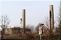
Railway Beside Taylors Lane Power Station
A Semaphore signal and disused telegraph pole stand beside the tracks of the Midland Railway's Acton Wells to Cricklewood line. Behind are the chimneys and oil tanks of Taylors Lane Power Station. The current power station which opened in 1979 on the site of a previous one, is powered by gas-oil. There are sidings beside the tanks for rail deliveries but these are no longer connected to the rail network so presumably delivery of oil is now carried out by road.
Image: © Martin Addison
Taken: 1 Mar 2012
0.09 miles
10
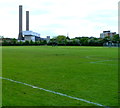
Taylor's Lane Power Station chimneys, Willesden
Viewed across Gibbons Recreation Ground.
http://www.geograph.org.uk/photo/2833248 to a closer view of the power station and some details.
Image: © Jaggery
Taken: 13 May 2012
0.09 miles