IMAGES TAKEN NEAR TO
Station Terrace, LONDON, NW10 5RT
Introduction
This page details the photographs taken nearby to Station Terrace, NW10 5RT by members of the Geograph project.
The Geograph project started in 2005 with the aim of publishing, organising and preserving representative images for every square kilometre of Great Britain, Ireland and the Isle of Man.

There are currently over 7.5m images from over14,400 individuals and you can help contribute to the project by visiting https://www.geograph.org.uk
Image Map (Loading...)


Getting Data...Please wait
Leaflet Map data © OpenStreetMap
Images are licensed for reuse under creativecommons.org/licenses/by-sa/2.0
Notes
- Clicking on the map will re-center to the selected point.
- The higher the marker number, the further away the image location is from the centre of the postcode.
Image Listing (166 Images Found)
Images are licensed for reuse under creativecommons.org/licenses/by-sa/2.0
Image
Details
Distance

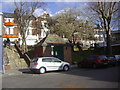
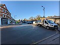
3
Linden Avenue / Station Terrace, NW10
Shows the location of Image
Image: © Mike Quinn
Taken: 7 Sep 2011
0.02 miles
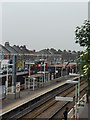
4
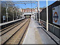
Kensal Rise railway station, Greater London
Opened in 1873 as Kensal Green on the Hampstead Junction Railway line from Dalston to Willesden, this station was renamed to Kensal Rise in 1890.
View north east towards Brondesbury Park and Dalston.
Image: © Nigel Thompson
Taken: 2 Apr 2013
0.02 miles
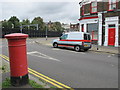
5
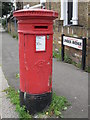
Victorian postbox, Linden Avenue / Station Terrace, NW10
Image: © Mike Quinn
Taken: 7 Sep 2011
0.02 miles
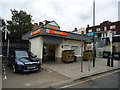
6
View outside (just to the south) of Kensal Rise station
Image: © Tom Page
Taken: 20 Jan 2022
0.02 miles
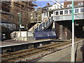
10
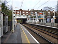
Kensal Rise Station
Looking east. This is a station on the North London line of the Overground. It was opened as Kensal Green & Harlesden on 1 November 1861. In 1890 it was renamed as Kensal Rise.
For many years this station, along with others on this line, had just a miserable service of half-hourly trains between Richmond and Broad Street. The stations became run-down and vandalised, so it was no surprise when the line was slated for closure by Beeching. However, it survived and now, under the Overground, this line has been transformed, with a frequent service of clean, bright trains that are very well used. This was certainly one case where Beeching was quite mistaken.
Image: © Dr Neil Clifton
Taken: 25 Nov 2015
0.02 miles