IMAGES TAKEN NEAR TO
Wells Road, FAKENHAM, NR21 9NU
Introduction
This page details the photographs taken nearby to Wells Road, NR21 9NU by members of the Geograph project.
The Geograph project started in 2005 with the aim of publishing, organising and preserving representative images for every square kilometre of Great Britain, Ireland and the Isle of Man.

There are currently over 7.5m images from over14,400 individuals and you can help contribute to the project by visiting https://www.geograph.org.uk
Image Map
Images are licensed for reuse under creativecommons.org/licenses/by-sa/2.0
Notes
- Clicking on the map will re-center to the selected point.
- The higher the marker number, the further away the image location is from the centre of the postcode.
Image Listing (10 Images Found)
Images are licensed for reuse under creativecommons.org/licenses/by-sa/2.0
Image
Details
Distance
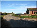
2
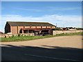
Barn beside the B1105 road
The barn is situated by the junction of Hand Lane and the B1105 road.
Image: © Evelyn Simak
Taken: 21 Oct 2010
0.04 miles
3
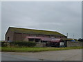
Field Barn on Hand Lane near West Barsham
A view from the end of Spring Lane looking over the B1105 on a damp Norfolk afternoon
Image: © Richard Humphrey
Taken: 19 Oct 2012
0.05 miles
5
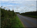
The B1105 road past a barn by the junction with Hand Lane
Hand Lane here joins the B1105 road. Another lane continues on the other side (at left). It is called Spring Lane and leads to Waterden Farm, further to the north-west.
Image: © Evelyn Simak
Taken: 21 Oct 2010
0.07 miles
6
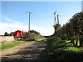
Hand Lane
Followed in the view direction the track leads to the road which links West and North Barsham, further to the west. For a view of its other end see > http://www.geograph.org.uk/photo/2122143.
Image: © Evelyn Simak
Taken: 21 Oct 2010
0.08 miles
8
Spring Lane
Spring Lane continues from Hand Lane > http://www.geograph.org.uk/photo/2122345 - on the other side of the B1105 - leading to Waterden Farm further to the north-west.
Image: © Evelyn Simak
Taken: 21 Oct 2010
0.12 miles
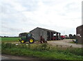
9
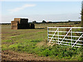
Stacks of straw bales in field south of Spring Lane
Image: © Evelyn Simak
Taken: 21 Oct 2010
0.18 miles
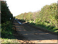
10
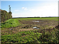
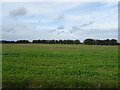
Field south of Hand Lane
The lane is obscured from view by the hedge seen at left.
Image: © Evelyn Simak
Taken: 21 Oct 2010
0.18 miles