1
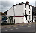
West along St Michael's Road, Abergavenny
Dead-end road connecting with the A40 behind camera.
Image: © Jaggery
Taken: 29 Dec 2019
0.02 miles
2
Scaffolding on Trelough House, 13 Brecon Road, Abergavenny
Viewed from the corner of Merthyr Road on September 30th 2018.
Image: © Jaggery
Taken: 30 Sep 2018
0.03 miles
3
Heronhurst, Abergavenny
Windows and doors retailer at 33-35 Brecon Road.
Image: © Jaggery
Taken: 7 Feb 2014
0.03 miles
4
H. Shackleton Pharmacy, 33 Brecon Road, Abergavenny
In newly-built premises on the north side of the A40 Brecon Road viewed on September 30th 2018.
A May 2018 Google Earth Street View shows a fenced-off building site here with these buildings under scaffolding.
Image: © Jaggery
Taken: 30 Sep 2018
0.03 miles
5
Junction of Merthyr Road and Brecon Road, Abergavenny
Merthyr Road joins the A40 Brecon Road.
Image: © Jaggery
Taken: 30 Sep 2018
0.03 miles
6
Direction and distances signs, Brecon Road, Abergavenny
On the north side of the A40 Brecon Road facing the Merthyr Road junction.
Left for Brecon (20 miles), right for Monmouth (16), Hereford (22), Cwmbran (14), Newport (18).
The Welsh names for Brecon, Monmouth and Newport are also shown.
Image: © Jaggery
Taken: 30 Sep 2018
0.03 miles
7
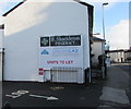
H.Shackleton Pharmacy name on a Brecon Road side wall, Abergavenny
A few metres from the pharmacy. https://www.geograph.org.uk/photo/5990842
Image: © Jaggery
Taken: 29 Dec 2019
0.03 miles
8
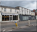
J.Charles shop, 11 Brecon Road, Abergavenny
The nameboard shows P. Witherstone & Son t/a (trading as) J.Charles.
The shop's business is repairs for TV, video, satellite etc.
Image: © Jaggery
Taken: 30 Sep 2018
0.03 miles
9
St Michael's Road, Abergavenny
Looking towards the A40.
The whitewashed building has two doors, one at street level, the other at first floor level.
Image: © Jaggery
Taken: 15 Jul 2012
0.03 miles
10
Abergavenny: Brecon Road, near former station, 1990
View eastward, away from site of former Brecon Road station, which was on the ex-LNW Abergavenny Junction - Brynmawr - Merthyr line - closed in 1/58.
Image: © Ben Brooksbank
Taken: 21 May 1990
0.04 miles


