1
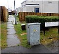
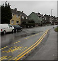
Corner of Varteg Road and Penylan Road, Varteg
Looking in the direction of Garndiffaith.
Image: © Jaggery
Taken: 12 May 2010
0.02 miles
2
Path into Woodland View, Varteg
From the B4246 into Woodland View, an area of flats between Varteg Road and Penylan Road.
The sign on the right shows that Woodland View is Trem y Goedlan in Welsh.
Image: © Jaggery
Taken: 28 Jun 2017
0.02 miles
3
Ascent from Balance Road bus stop, Garndiffaith
Looking up the B4246 Varteg Road from the bus stop near the Balance Road junction. https://www.geograph.org.uk/photo/6343022
Image: © Jaggery
Taken: 12 Dec 2019
0.03 miles
4
Woodland View flats, Varteg
Viewed across the B4246 Varteg Road, the main road through the village.
Image: © Jaggery
Taken: 28 Jun 2017
0.04 miles
5
Varteg Road bus stop, shelter and bench, Varteg
This side of the B4246 Varteg Road for buses to Abersychan, Pontypool, Cwmbran, Newport and places in between. A small plaque on the bench shows PROVIDED BY PONTYPOOL COMMUNITY COUNCIL.
Image: © Jaggery
Taken: 28 Jun 2017
0.04 miles
6
Green house, Varteg Road, Varteg
This house alongside the B4246 Varteg Road is northeast of the Balance Road junction.
Image: © Jaggery
Taken: 12 Dec 2019
0.04 miles
7
BT telecoms cabinet on a Varteg corner
On the corner of Varteg Road and Balance Road, viewed in June 2017.
No cabinet appears in a May 2011 Google Earth Street View of this corner.
Image: © Jaggery
Taken: 28 Jun 2017
0.05 miles
8
Dark green cabinet on a Garndiffaith corner
The telecoms cabinet on the right is on the corner of the B4246 Varteg Road and Balance Road.
Image: © Jaggery
Taken: 12 Dec 2019
0.05 miles
9
Penylan Road electricity substation, Varteg
The Western Power Distribution electricity substation identifier is PENYLAN ROAD S/S 53-2697.
Image: © Jaggery
Taken: 25 Sep 2015
0.05 miles
10
Varteg Road semis, Varteg
Semi-detached houses alongside the B4246 Varteg Road, the main road through the village.
Image: © Jaggery
Taken: 28 Jun 2017
0.05 miles


