1
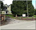
Greenway Drive bungalows, Griffithstown, Pontypool
Greenway Drive is on the north side of Cwrdy Road.
Image: © Jaggery
Taken: 18 Apr 2013
0.05 miles
2
Greenhill Road houses, Griffithstown, Pontypool
Houses at the northern end of Greenhill Road, on the corner of Kemys Street. Just out of shot on the opposite corner (of Kemys Street and Sunnybank Road) is St Hilda's church. http://www.geograph.org.uk/photo/1577404
Image: © Jaggery
Taken: 21 Jan 2011
0.06 miles
3
St John Ambulance hall, Griffithstown, Pontypool
Located in Greenway Drive near the Cwrdy Road junction.
Image: © Jaggery
Taken: 8 Oct 2011
0.07 miles
4
Entrance to Greenways Social Club, Griffithstown, Pontypool
Viewed across Greenway Drive. Many references show Greenway Club, but two name signs here show Greenways Club.
Image: © Jaggery
Taken: 18 Apr 2013
0.08 miles
5
St Hilda's Church rooftop , Griffithstown, Pontypool
A closeup view of the church http://www.geograph.org.uk/photo/1577394 chimney and weather vane.
Image: © Jaggery
Taken: 21 Oct 2009
0.09 miles
6
St Hilda's Church , Griffithstown, Pontypool
The view from the southwest. The church is on the corner of Sunnybank Road and Kemys Street. http://www.geograph.org.uk/photo/1577394 for the view from the southeast.
Image: © Jaggery
Taken: 21 Oct 2009
0.09 miles
7
St Hilda's Church , Griffithstown, Pontypool
The view of the church from the southeast, on Kemys Street. St Hilda's Church is the Church in Wales (Anglican) parish church of Griffithstown. Built in 1887, it is a stone edifice in the Early English style, consisting of chancel, nave, aisles and south porch. http://www.geograph.org.uk/photo/1577404 to view from the southwest.
Image: © Jaggery
Taken: 21 Oct 2009
0.09 miles
8
Greenway Drive, Griffithstown, Pontypool
A view north from the corner of a side street leading to Greenway Close.
Image: © Jaggery
Taken: 18 Apr 2013
0.09 miles
9
Glengariff Court, Griffithstown, Pontypool
Viewed from Greenhill Road.
Image: © Jaggery
Taken: 21 Oct 2009
0.09 miles
10
Greenhill Road postbox, Griffithstown, Pontypool
The Glengariff Court junction http://www.geograph.org.uk/photo/1577335 is on the right.
Image: © Jaggery
Taken: 24 Jan 2015
0.09 miles


