St Hilda's Church , Griffithstown, Pontypool
Introduction
The photograph on this page of St Hilda's Church , Griffithstown, Pontypool by Jaggery as part of the Geograph project.
The Geograph project started in 2005 with the aim of publishing, organising and preserving representative images for every square kilometre of Great Britain, Ireland and the Isle of Man.

There are currently over 7.5m images from over 14,400 individuals and you can help contribute to the project by visiting https://www.geograph.org.uk
St Hilda's Church , Griffithstown, Pontypool
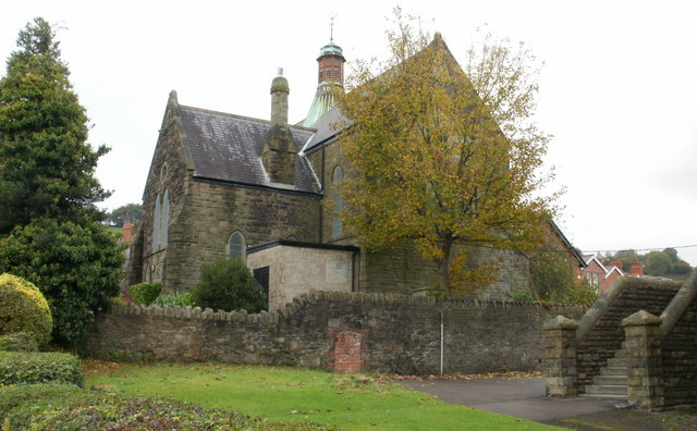
Image: © Jaggery Taken: 21 Oct 2009
The view of the church from the southeast, on Kemys Street. St Hilda's Church is the Church in Wales (Anglican) parish church of Griffithstown. Built in 1887, it is a stone edifice in the Early English style, consisting of chancel, nave, aisles and south porch. http://www.geograph.org.uk/photo/1577404 to view from the southwest.
Images are licensed for reuse under creativecommons.org/licenses/by-sa/2.0
Image Location
Latitude
51.684352
Longitude
-3.028397