1
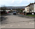
East Road west of South Road, Oakfield, Cwmbran
Looking west along East Road past the T-junction with South Road. http://www.geograph.org.uk/photo/3363269
Image: © Jaggery
Taken: 9 Mar 2013
0.04 miles
2
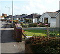
East Road, Oakfield, Cwmbran
Viewed across Green Willows.
East Road is in a part of Oakfield with prosaic street names. Other examples are South Road, Fields Road, The Highway and The Close. The local council's street naming department must have had an off day if the best they could come up with was The Close and The Highway...
Image: © Jaggery
Taken: 9 Mar 2013
0.05 miles
3
Row of bungalows, The Highway, Oakfield, Cwmbran
Viewed from the corner of The Close. This is the middle block of three rows of bungalows forming and arc in the central part of The Highway.
Image: © Jaggery
Taken: 30 Jul 2010
0.06 miles
4
West along East Road, Oakfield, Cwmbran
From the road named Green Willows along East Road towards South Road and The Highway.
Image: © Jaggery
Taken: 23 Mar 2018
0.06 miles
5
The Close, Oakfield, Cwmbran
Houses on the west side of The Close, viewed from the corner of Fields Road.
The Close is not a close, as it is connected to Fields Road and The Highway.
It may be that the local street naming department had an uninspired day when naming The Close and The Highway. Another possibility is that these were the original streets in Oakfield when all else around was undeveloped. That was the case in New Inn, where the first streets named were The Highway http://www.geograph.org.uk/photo/1666569 and The Avenue. http://www.geograph.org.uk/photo/1666551
Image: © Jaggery
Taken: 30 Jul 2010
0.07 miles
6
Bungalows, Oakfield Road, Cwmbran
Looking ESE along the south side of Oakfield Road, in the direction of the turning for the residential road Green Willows.
Image: © Jaggery
Taken: 27 Oct 2010
0.08 miles
7
East Road bungalows, Oakfield, Cwmbran
The bungalows face South Road. http://www.geograph.org.uk/photo/3363269
Image: © Jaggery
Taken: 9 Mar 2013
0.08 miles
8
Oakfield Mews, Cwmbran
Houses built in 2007, viewed from Oakfield Road.
Image: © Jaggery
Taken: 15 Oct 2009
0.08 miles
9
The Highway, Oakfield, Cwmbran
The Highway heads away from Oakfield Road towards East Road.
Image: © Jaggery
Taken: 15 Oct 2009
0.08 miles
10
East side of The Highway, Oakfield, Cwmbran
Houses on the east side of The Highway, viewed from the corner of Oakfield Road.
Image: © Jaggery
Taken: 27 Oct 2010
0.08 miles


