1
Holly Lodge Gardens, Croesyceiliog
From the junction with The Highway.
Image: © Jaggery
Taken: 8 Oct 2009
0.03 miles
2
Yew Tree Terrace, Croesyceiliog, Cwmbran
Ascending from North Road to Brynhyfryd.
Image: © Jaggery
Taken: 28 Feb 2018
0.08 miles
3
Pettingale Road, Croesyceiliog
This is the northern end of Pettingale Road, at the junction with The Highway.
The southern end joins The Highway about 400 metres to the south, having looped around and run parallel to the A4042 (Croesyceiliog Bypass) for most of its length.
Image: © Jaggery
Taken: 8 Oct 2009
0.08 miles
4
Yew Tree Terrace, Croesyceiliog, Cwmbran
Viewed from North Road.
Image: © Jaggery
Taken: 15 Feb 2015
0.09 miles
5
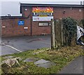
Croesyceiliog Cricket & Rugby Club information board, Cwmbran
Viewed from The Highway in December 2023. Text on the board includes
"NON MEMBERS WELCOME!" and "OPEN 7 DAYS A WEEK"
Image: © Jaggery
Taken: 24 Dec 2023
0.09 miles
6
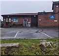
Function room entrance, Croesyceiliog, Cwmbran
The entrance to Croesyceiliog Cricket & Rugby Club's function room.
Image: © Jaggery
Taken: 24 Dec 2023
0.10 miles
7
Very outdated information, The Highway, Croesyceiliog, Cwmbran
On Christmas Eve 2023 the board shows
CROESYCEILIOG RUGBY CLUB
NEXT HOME FIXTURE
V
BEDWAS RFC
SAT 26 SEP 2015
Image: © Jaggery
Taken: 24 Dec 2023
0.10 miles
8
The Upper Cock Inn, Croesyceiliog
Located on The Highway, adjacent to the junction with the Garw. The weather vane,on the left edge of the main roof, has an appropriate shape.
The name Croesyceiliog, the Cock's Cross, may derive from a large sculptured crowing cock that used to be on a mound in a field near the Inn. It was possibly a medieval reference to St Peter's denial of Jesus. The sculpture is thought to have been destroyed by Cromwell's troops in the mid 17th century during their pillaging of the countryside.
Image: © Jaggery
Taken: 8 Oct 2009
0.12 miles
9
Stone pillar, The Upper Cock, Croesyceiliog
This three-sided stone pillar is in the forecourt of The Upper Cock Inn http://www.geograph.org.uk/photo/1526053. The side seen here faces The Highway. The inscription reads
Here is an inn - the cross of the cock.
A welcome is yours for a penny,
For payment so small,
Good beer waits for you all,
Come in, taste our ale, good as any.
There is no date on the inscription, but the stone appears to be much too new to have been erected when beer was a penny a pint.
On another side is the Welsh version of the text. The third side is blank.
Image: © Jaggery
Taken: 8 Oct 2009
0.12 miles
10
Croesyceiliog Cricket and Rugby Club
The clubhouse is located at the junction of The Garw and The Highway.
The rugby and cricket pitches are on the other side of the clubhouse.
Croesyceiliog Cricket Club play in the South Wales Premier League (2009 season).
Croesyceiliog Rugby Club play in the Welsh Division Three East.
Image: © Jaggery
Taken: 8 Oct 2009
0.12 miles


