The Upper Cock Inn, Croesyceiliog
Introduction
The photograph on this page of The Upper Cock Inn, Croesyceiliog by Jaggery as part of the Geograph project.
The Geograph project started in 2005 with the aim of publishing, organising and preserving representative images for every square kilometre of Great Britain, Ireland and the Isle of Man.

There are currently over 7.5m images from over 14,400 individuals and you can help contribute to the project by visiting https://www.geograph.org.uk
The Upper Cock Inn, Croesyceiliog
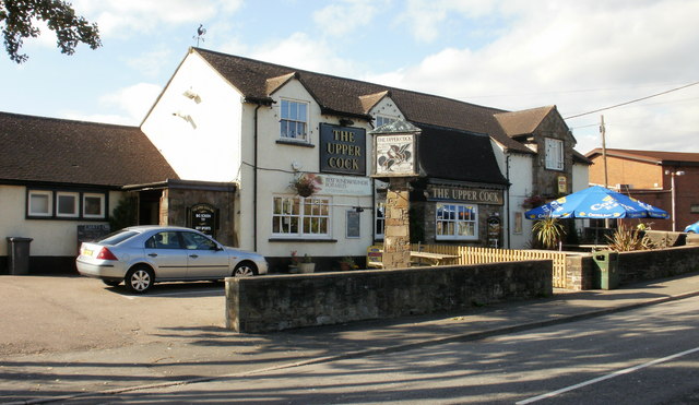
Image: © Jaggery Taken: 8 Oct 2009
Located on The Highway, adjacent to the junction with the Garw. The weather vane,on the left edge of the main roof, has an appropriate shape. The name Croesyceiliog, the Cock's Cross, may derive from a large sculptured crowing cock that used to be on a mound in a field near the Inn. It was possibly a medieval reference to St Peter's denial of Jesus. The sculpture is thought to have been destroyed by Cromwell's troops in the mid 17th century during their pillaging of the countryside.
Images are licensed for reuse under creativecommons.org/licenses/by-sa/2.0
Image Location
Latitude
51.661179
Longitude
-3.00474