1
Portskewett : Caldicot Road approaches crossroads
A white-on-pink bilingual SLOW/ARAF (Welsh) sign on the road surface is alongside a sign advising of crossroads ahead - Crick Road from the north and Manor Way from the south. Below the sign, a white-on-blue sign advises of a 7.5 tonne limit on Crick Road. Behind the crossroads sign is a school sign. Archbishop Rowan Williams Church in Wales Voluntary Aided Primary School is nearby.
Image: © Jaggery
Taken: 8 Sep 2010
0.05 miles
2
Portskewett : Oaklands Park
Oaklands Park off Crick Road.
Image: © Lewis Clarke
Taken: 15 Jul 2020
0.07 miles
3
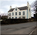
Grade II Listed Old Rectory, Portskewett
On the corner of Crick Road and Oaklands Park, the 18th century building with later alterations ceased being a rectory in the late 20th century. A distinctive feature is the 8-pane circular window in the gable.
Image: © Jaggery
Taken: 11 Mar 2018
0.07 miles
4
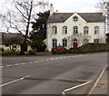
Old Rectory, Portskewett
Located on the corner of Crick Road and Oaklands Park, the Grade II listed
18th century building with later alterations ceased being a rectory in the late 20th century.
Image: © Jaggery
Taken: 11 Mar 2018
0.07 miles
5
Portskewett : Crick Road
Looking along Crick Road.
Image: © Lewis Clarke
Taken: 15 Jul 2020
0.07 miles
6
Oaklands Park, Portskewett
Cul-de-sac on the southwest side of Crick Road.
Image: © Jaggery
Taken: 11 Mar 2018
0.07 miles
7
West along Caldicot Road, Portskewett
Viewed across the southeast end of Crick Road. A nearby sign https://www.geograph.org.uk/photo/5710648 shows a mile and a half to Caldicot.
Image: © Jaggery
Taken: 11 Mar 2018
0.07 miles
8
Portskewett : Tree Tops
Looking along Tree Tops off Crick Road.
Image: © Lewis Clarke
Taken: 15 Jul 2020
0.08 miles
9
Portskewett : Portskewett Church Hall
Portskewett and Sudbrook Church Hall is suitable for a variety of Events and Functions.
Image: © Lewis Clarke
Taken: 15 Jul 2020
0.08 miles
10
Portskewett : Portskewett Church Hall
Portskewett and Sudbrook Church Hall is suitable for a variety of events and functions.
Image: © Lewis Clarke
Taken: 15 Jul 2020
0.08 miles


