IMAGES TAKEN NEAR TO
Penhow, CALDICOT, NP26 3GB
Introduction
This page details the photographs taken nearby to NP26 3GB by members of the Geograph project.
The Geograph project started in 2005 with the aim of publishing, organising and preserving representative images for every square kilometre of Great Britain, Ireland and the Isle of Man.

There are currently over 7.5m images from over14,400 individuals and you can help contribute to the project by visiting https://www.geograph.org.uk
Image Map
Images are licensed for reuse under creativecommons.org/licenses/by-sa/2.0
Notes
- Clicking on the map will re-center to the selected point.
- The higher the marker number, the further away the image location is from the centre of the postcode.
Image Listing (16 Images Found)
Images are licensed for reuse under creativecommons.org/licenses/by-sa/2.0
Image
Details
Distance
1
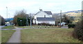
The Gables near Parc Seymour
House on the corner of the A48 and a country lane along the western edge of the village of Parc Seymour.
Image: © Jaggery
Taken: 28 Jan 2011
0.04 miles
2
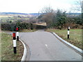
Lane along the western edge of Parc Seymour
A lane heads north away from the A48, past the left turn into The Gables. http://www.geograph.org.uk/photo/2267540
It should be obvious to most drivers, but a sign behind the camera states that the route ahead is unsuitable for heavy goods vehicles.
Image: © Jaggery
Taken: 28 Jan 2011
0.04 miles
3
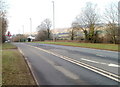
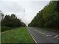
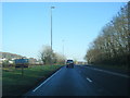
A48 approaches a minor road near Parc Seymour
The view WSW along the A48 near Parc Seymour. The road sign shows a right turn ahead into a minor road - a lane http://www.geograph.org.uk/photo/2267555 skirting the western edge of the village of Parc Seymour.
Image: © Jaggery
Taken: 28 Jan 2011
0.07 miles
4
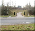
Entrance drive to Hunters Lodge near Llandevaud
The entrance is on the south side of the A48, almost opposite The Gables. http://www.geograph.org.uk/photo/2267540
Image: © Jaggery
Taken: 28 Jan 2011
0.07 miles
6
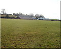
Field and farm buildings viewed from the A48
The view SW from the A48, between Parc Seymour and Llandevaud.
Image: © Jaggery
Taken: 28 Jan 2011
0.13 miles
8
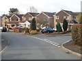
Meadowlands Close houses, Parc Seymour
Viewed from near the corner of Greenmeadow Drive.
Image: © Jaggery
Taken: 28 Jan 2011
0.15 miles
10
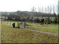
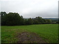
Children's play area, Parc Seymour
The play area is on the south side of Greenmeadow Drive, at the NW edge of a recreation area.
Image: © Jaggery
Taken: 28 Jan 2011
0.16 miles