1
Llandogo
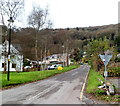
The village sits on the steep western side of the Wye valley gorge.
View from the south on a winter morning as the sun reaches the hill tops beyond.
Image: © Jonathan Billinger
Taken: 17 Dec 2010
0.00 miles
2
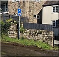
Ignore Satnav sign, Llandogo, Monmouthshire
Facing the A466, the main road through the village, the wordless sign is alongside a narrow lane.
HGV drivers who are directed along this lane should ignore their satnav.
Image: © Jaggery
Taken: 3 Mar 2024
0.03 miles
3
Llandogo Village from hillside
Taken in 1964 from 'The Priory' when the establishment was a centre run by the Holiday Fellowship. Image shows Llandogo village with church of St Oudoceus visible on left. Bend in River Wye in mid-distance.
Image: © Clint Mann
Taken: Unknown
0.04 miles
4
Llandogo Primary School
Located at the western end of Holmfield Drive, next to the Millennium Hall. http://www.geograph.org.uk/photo/2719997
Image: © Jaggery
Taken: 4 Dec 2011
0.04 miles
5
Public footpath direction sign, Llandogo, Monmouthshire
The sign at the edge of the Sloop Inn car park points to the NW,
away from the A466, the main road through the village.
Image: © Jaggery
Taken: 3 Mar 2024
0.05 miles
6
IMPORTANT NOTICE in the Sloop Inn Car Park, Llandogo, Monmouthshire
Text on the notice in March 2024 includes "CUSTOMER PARKING ONLY" and
"Failure to comply may result in a Parking Charge Notice of £100"
Image: © Jaggery
Taken: 3 Mar 2024
0.05 miles
7
Road to Cleddon and Trelleck from Llandogo
Viewed across the A466. A sign behind the camera shows that Trelleck (also spelt Trellech) is 2½ miles away.
Image: © Jaggery
Taken: 4 Dec 2011
0.05 miles
8
Sunday Roast information, Llandogo, Monmouthshire
In the Sloop Inn car park, facing the A466.
The Sloop Inn is on the opposite side of the A466.
Image: © Jaggery
Taken: 3 Mar 2024
0.05 miles
9
Ordnance Survey Flush Bracket G3918
This can be found on the roadside wall of the Sloop Inn in Llandogo.
For more detail see : http://www.bench-marks.org.uk/bm15763
Image: © Peter Wood
Taken: 17 Oct 2016
0.05 miles
10
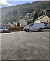
The Sloop Inn Car Park, Llandogo, Monmouthshire
On the west side of the A466, the main road through the village.
The Sloop Inn is on the opposite side of the A466.
Image: © Jaggery
Taken: 3 Mar 2024
0.06 miles


