IMAGES TAKEN NEAR TO
Mortons Farm, EBBW VALE, NP23 4HS
Introduction
This page details the photographs taken nearby to Mortons Farm, NP23 4HS by members of the Geograph project.
The Geograph project started in 2005 with the aim of publishing, organising and preserving representative images for every square kilometre of Great Britain, Ireland and the Isle of Man.

There are currently over 7.5m images from over14,400 individuals and you can help contribute to the project by visiting https://www.geograph.org.uk
Image Map (Loading...)


Getting Data...Please wait
Leaflet Map data © OpenStreetMap
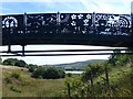
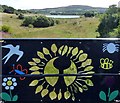
Images are licensed for reuse under creativecommons.org/licenses/by-sa/2.0
Notes
- Clicking on the map will re-center to the selected point.
- The higher the marker number, the further away the image location is from the centre of the postcode.
Image Listing (29 Images Found)
Images are licensed for reuse under creativecommons.org/licenses/by-sa/2.0
Image
Details
Distance
1
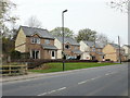
Croft Court, Brynmawr
Croft Court is a small group of houses on the south side of King Street, close to the Beaufort border.
Image: © Jaggery
Taken: 28 Apr 2010
0.05 miles
3
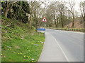
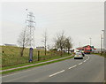
The western edge of Brynmawr
The A4047 heads away from Beaufort towards the Brynmawr boundary.
Brynmawr, at an average elevation of 1,200 feet (about 365 metres) above sea level is the highest town in South Wales. It is twinned with Camors (Brittany, France).
Image: © Jaggery
Taken: 28 Apr 2010
0.13 miles
4
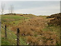
Moorland adjacent to A4047
Moorland viewed from the A4047 at an elevation of about 1200 feet (365 metres) above sea level, near the Beaufort/Brynmawr border.
Image: © Jaggery
Taken: 28 Apr 2010
0.13 miles
5
A4047 reaches Beaufort
The A4047, having left Brynmawr, reaches Beaufort, as shown by the vertical blue sign.
Image: © Jaggery
Taken: 28 Apr 2010
0.13 miles
6
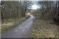
National Cycle Route 46, Parc Nant-y-Waun
Cycle/pedestrian path on former railway track bed above Machine Pond.
Image: © M J Roscoe
Taken: 7 Feb 2017
0.15 miles
7
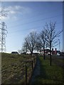
Power transmission line, ice-tipped branches, and filling station, Brynmawr
Image: © John Lord
Taken: 11 Feb 2012
0.17 miles
8
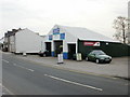
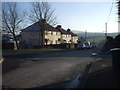
Merthyr Road Garage, Brynmawr
Despite its name, the garage is located on King Street, on the corner of Bath Lane.
Image: © Jaggery
Taken: 28 Apr 2010
0.18 miles
9
Parc Nant-y-Waun, Brynmawr
Looking towards Machine Pond from underneath the colourful footbridge http://www.geograph.org.uk/photo/3609710 .
Image: © Robin Drayton
Taken: 16 Aug 2013
0.19 miles
10
A view from the colourful footbridge, Parc Nant-y-Waun, Brynmawr
Looking towards the Machine Pond from the footbridge http://www.geograph.org.uk/photo/3609710 .
Image: © Robin Drayton
Taken: 16 Aug 2013
0.19 miles