The western edge of Brynmawr
Introduction
The photograph on this page of The western edge of Brynmawr by Jaggery as part of the Geograph project.
The Geograph project started in 2005 with the aim of publishing, organising and preserving representative images for every square kilometre of Great Britain, Ireland and the Isle of Man.

There are currently over 7.5m images from over 14,400 individuals and you can help contribute to the project by visiting https://www.geograph.org.uk
The western edge of Brynmawr
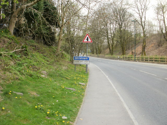
Image: © Jaggery Taken: 28 Apr 2010
The A4047 heads away from Beaufort towards the Brynmawr boundary. Brynmawr, at an average elevation of 1,200 feet (about 365 metres) above sea level is the highest town in South Wales. It is twinned with Camors (Brittany, France).
Images are licensed for reuse under creativecommons.org/licenses/by-sa/2.0
Image Location
Latitude
51.79971
Longitude
-3.190544