IMAGES TAKEN NEAR TO
St. Clares, TREDEGAR, NP22 5JN

Introduction

This page details the photographs taken nearby to St. Clares, NP22 5JN by members of the Geograph project.

The Geograph project started in 2005 with the aim of publishing, organising and preserving representative images for every square kilometre of Great Britain, Ireland and the Isle of Man.

There are currently over 7.5m images from over14,400 individuals and you can help contribute to the project by visiting https://www.geograph.org.uk

Image Map


Images are licensed for reuse under creativecommons.org/licenses/by-sa/2.0
Notes
  • Clicking on the map will re-center to the selected point.
  • The higher the marker number, the further away the image location is from the centre of the postcode.

Image Listing (131 Images Found)

Images are licensed for reuse under creativecommons.org/licenses/by-sa/2.0
  • ...
Image
Details
Distance
1
Unnamed side road at the southern edge of Rhymney
Dead-end road on the west side of the B4257 Wellington Way.
Image: © Jaggery Taken: 4 May 2019
0.02 miles
2
Old pit wheels at Rhymney
Image: © Anthony Gostling Taken: 22 Mar 2009
0.04 miles
3
B4257 at Rhymney boundary
Image: © Colin Pyle Taken: 21 Apr 2018
0.05 miles
4
Bus shelter on a small triangle, Rhymney
At the southern edge of Rhymney, this stop on the B4257 Wellington Way is for buses to Tredegar or Merthyr Tydfil via High Street Rhymney.
Image: © Jaggery Taken: 4 May 2019
0.06 miles
5
Ascent towards Rhymney
The B4257 from Pontlottyn ascends towards the southern edge of Rhymney.
Image: © Jaggery Taken: 4 May 2019
0.07 miles
6
Southern boundary of Rhymney
The B4257 from Pontlottyn reaches Rhymney (Rhymni in Welsh). Turn right for the road to Abertysswg.
Image: © Jaggery Taken: 4 May 2019
0.07 miles
7
Colliery memorial, Rhymney
The twin pit head wheels have been sited here in memory of the former coal mine. All over the Valleys it seems to me that the people are keen to forget the past, move on and look to the present and future. Here at least you can dwell in thought for a few minutes on a lifetime of manual labour underground and at least thank your lucky stars that you don't have to do that.
Image: © Jeremy Bolwell Taken: 16 Sep 2012
0.07 miles
8
Path into Rhymney
The boundary sign at the southern edge of Rhymney is on the left.
Image: © Jaggery Taken: 4 May 2019
0.07 miles
9
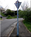
Cycle route 468 marker near Rhymney
On a traffic sign pole alongside the minor road from Rhymney to Abertysswg. National Cycle Network route 468 extends from Bargoed to the Rhymney Valley via New Tredegar.
Image: © Jaggery Taken: 4 May 2019
0.07 miles
10
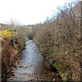
Rhymney River flows towards Pont Lottyn, Pontlottyn
Viewed from this bridge. http://www.geograph.org.uk/photo/3425655
Image: © Jaggery Taken: 19 Apr 2013
0.07 miles
  • ...