1
Tarmac's readymix concrete plant at Trefil quarry
Back under the ownership of Tarmac after a few years with Hope Construction Materials and then Breedon Aggregates.
Image: © Richard Law
Taken: 3 Jul 2018
0.07 miles
2
Former Brinore Tramroad, Trefil
An information board and stone are located alongside what is now Trefil Road.
The inscription on the stone shows BRINORE TRAMROAD OPENED 1815.
An arrow on the stone points left (NW) towards Talybont-on-Usk, 8 miles away.
Image: © Jaggery
Taken: 22 Aug 2013
0.09 miles
3
Road closed 100 yards ahead, Trefil
The road ahead is closed in the sense that it is a private road and bridleway. A notice ahead states that anyone using an unauthorised vehicle on the private road (or adjacent land) is liable to have the vehicle confiscated by the police.
Image: © Jaggery
Taken: 22 Aug 2013
0.09 miles
4
Trefil Village
Image: © Colin Pyle
Taken: 4 Jan 2019
0.09 miles
5
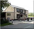
Tafarn Tŷ Uchaf, Trefil
The village pub is located alongside Trefil Road at about 410 metres (c 1,345 ft) above sea level.
On the name board, the pub's English name Top House is in smaller text below its Welsh name
Tafarn Tŷ Uchaf.
Image: © Jaggery
Taken: 22 Aug 2013
0.10 miles
6
Ordnance Survey Cut Mark
This OS cut mark can be found on the works building NE of road. It marks a point 414.050m above mean sea level.
Image: © Adrian Dust
Taken: 21 Sep 2016
0.10 miles
7
Looking towards the cattle grid on the edge of the moorland at Trefil
Image: © Rod Allday
Taken: 20 Apr 2014
0.11 miles
8
Northern boundary of Trefil
An inconspicuous vertical trefil in lower-case white letters is on a post on the left side of the sheep grid. Trefil is a small village north of Tredegar, in the county borough of Blaenau Gwent.
Image: © Jaggery
Taken: 22 Aug 2013
0.11 miles
9
Warning notices at the southern end of a private road near Trefil
The road ahead is closed to unauthorised cars, lorries and motorbikes because it is a private road and bridleway. The upper notice states that anyone using an unauthorised vehicle on the private road (or adjacent land) is liable to have the vehicle confiscated by the police. A bridleway means that walkers, horse riders or anyone leading a horse can use this road. I don't know whether or not it is legal for cyclists to ride here.
The lower notice shows No Tipping. Dump and you'll be dumped on. Flytipping fines can be up to £30,000.
Image: © Jaggery
Taken: 22 Aug 2013
0.11 miles
10
Grid across the road at the northern edge of Trefil
For much of its course ahead, the road is on or near the east bank of a stream, Nant Trefil, a tributary of the River Sirhowy. This is a private road and bridleway. A nearby notice states that anyone using an unauthorised vehicle on the private road (or adjacent land) is liable to have the vehicle confiscated by the police. A bridleway means that walkers, horse riders or anyone leading a horse can use this road.
I don't know whether or not it is legal for cyclists to ride here.
Image: © Jaggery
Taken: 22 Aug 2013
0.11 miles


