1
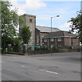
North side of St George's Court, Tredegar
Part of an extensive area of flats near St George's Church.
Image: © Jaggery
Taken: 7 Aug 2019
0.04 miles
2
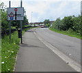
Crossroads sign on the approach to Tredegar town centre
Facing the unnamed road from the A4048 to Stockton Way and Commercial Street.
Image: © Jaggery
Taken: 1 Jun 2017
0.04 miles
3
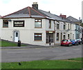
West side of St George's Court, Tredegar
Church Street side of an extensive area of flats near St George's Church.
Image: © Jaggery
Taken: 7 Aug 2019
0.05 miles
4
St George's Court, Tredegar
Tai Calon Community Housing flats on the east side of Church Street.
Image: © Jaggery
Taken: 1 Jun 2017
0.05 miles
5
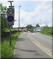
End of Clearway on the approach to Tredegar town centre
The Clearway zone (no stopping except in an emergency or traffic jam) ends here,
and the 40mph speed limit drops to 30mph on the approach to the town centre.
Image: © Jaggery
Taken: 1 Jun 2017
0.05 miles
6
St George's Vicarage, Tredegar
Located on the south side of St George's church, on the right here. http://www.geograph.org.uk/photo/5414034
Image: © Jaggery
Taken: 1 Jun 2017
0.06 miles
7
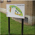
St George's Court map, Tredegar
Facing Church Street, the Tai Calon Community Housing map shows the location of the 130 flats in St George's Court. https://www.geograph.org.uk/photo/6231852 https://www.geograph.org.uk/photo/6231855
Image: © Jaggery
Taken: 7 Aug 2019
0.06 miles
8
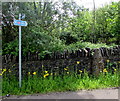
National Cycle Network Route 411 sign, Tredegar
Alongside a stone wall on the corner of the access road to Tredegar Business Park and an unnamed road from the A4048 to the town centre. National Cycle Network Route 411 is a short route extending from the edge of Tredegar town centre to Harford Gardens, a distance of about 500 metres.
Image: © Jaggery
Taken: 1 Jun 2017
0.06 miles
9
St George's Church and Vicarage, Tredegar
Viewed across Church Street. http://www.geograph.org.uk/photo/5414022 to a view of the north side of
the Grade II listed church in the Church in Wales Diocese of Monmouth.
Image: © Jaggery
Taken: 1 Jun 2017
0.06 miles
10
Sunkissed in Tredegar
Tanning and beauty salon at the southern end of Church Street.
Image: © Jaggery
Taken: 1 Jun 2017
0.06 miles


