1
Monnow Way bus stop and shelter, Bettws, Newport
One of many bus stops on Monnow Way which extends for about 4km around the Bettws Estate.
This one is near Parret Road and Parret Close.
Image: © Jaggery
Taken: 20 Aug 2018
0.02 miles
2
Parret Close, Bettws, Newport
Viewed across Monnow Way. Parret Close leads to Parret Walk, Meon Close and Tees Close.
Image: © Jaggery
Taken: 20 Aug 2018
0.02 miles
3
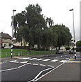
Zebra crossing, Monnow Way, Bettws, Newport
With a Belisha beacon and a street light on the same pole.
Image: © Jaggery
Taken: 20 Aug 2018
0.03 miles
4
Junction of Pentwyn Lane and Monnow Way, Bettws, Newport
The southeast end of Pentwyn Lane viewed across Monnow Way.
Image: © Jaggery
Taken: 20 Aug 2018
0.03 miles
5
Parret Close, Bettws, Newport
Viewed across Monnow Way. Parret Close leads to Tees Close and Meon Close.
Most streets in Bettws are named after rivers. The choice of names is interesting.
Doubtless many of the local residents (and also the occasional passing Geographer)
would not know even a rough location for some of river names used. For example, Meon was unknown to me when I took the photo. It is a fairly short river (21 miles or 38 kilometres) in Hampshire. http://www.geograph.org.uk/photo/1998625 The contributor of that photo stated "It is hardly big enough to qualify as a river".
Image: © Jaggery
Taken: 5 Sep 2010
0.03 miles
6
Parret Road, Bettws, Newport
A long row of 16 houses, viewed from Pentwyn Lane.
Image: © Jaggery
Taken: 5 Sep 2010
0.03 miles
7
Houses on two sides of a rectangle, Bettws, Newport
Viewed from a Monnow Way bus stop.
Image: © Jaggery
Taken: 20 Aug 2018
0.04 miles
8
Parret Walk, Bettws, Newport
Parret Walk heads away from Parret Road past the SE edge of Millbrook Primary School, towards Meon Close and Parret Close.
Image: © Jaggery
Taken: 5 Sep 2010
0.05 miles
9
Entrance to St David Lewis school, Bettws, Newport
This entrance to Saint David Lewis Roman Catholic Primary School is from Meon Close.
Saint David Lewis RC church is nearby. http://www.geograph.org.uk/photo/1567951
Image: © Jaggery
Taken: 5 Sep 2010
0.05 miles
10
Meon Close, Bettws, Newport
Houses on the east side of the close, viewed from Parret Close.
Image: © Jaggery
Taken: 5 Sep 2010
0.05 miles


