1
Abrupt end of the road in Mon Bank, Newport
Although signs at a new junction http://www.geograph.org.uk/photo/3736246 on Cardiff Road indicate that this is a through road, it isn't yet! Work is ongoing at the Redrow housing development Mon Bank, located on former railway land.
Eventually this will be a through road.
Image: © Jaggery
Taken: 24 Oct 2013
0.07 miles
2
New houses in Mon Bank, Newport
This late October 2013 view is of some of the first houses to be built in the Redrow development,
Mon Bank, on former railway land on the SE side of Cardiff Road.
Image: © Jaggery
Taken: 24 Oct 2013
0.07 miles
3
Children?s play area, Mon Bank, Newport
Image: © Robin Drayton
Taken: 20 Aug 2021
0.07 miles
4
Redrow Homes site office, Mon Bank, Newport
Viewed in July 2014 during ongoing house construction on former railway land south of Cardiff Road.
Image: © Jaggery
Taken: 12 Jul 2014
0.08 miles
5
Show houses, Mon Bank, Newport
These houses are part of a large development on an area of former railway sidings that was previously known as Monmouthshire Bank.
This is at the junction of Monmouth Castle Drive and Windsor Castle Road. Both names of steam locomotives.
Image: © Robin Drayton
Taken: 12 Oct 2017
0.09 miles
6
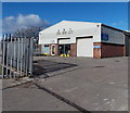
Jing Xing Ltd, Port Road, Newport
Located in unit 8, Port Road, Maesglas Industrial Estate, in premises formerly occupied by ATS Euromaster. Jing Xing is an importer, wholesaler and retailer of Chinese groceries and food products.
Image: © Jaggery
Taken: 5 Feb 2013
0.11 miles
7
Cae Brynton Road
This was once the junction of Cae Brynton Road with Cardiff Road. It was closed off over 40 years ago, but it is only in the past few years that this has been recognised by some automated route generation systems.
The land in the distance is Monmouthshire Bank Sidings, railway land that is now earmarked for residential development.
Image: © Robin Drayton
Taken: 1 Dec 2008
0.11 miles
8
Pavement through Mon Bank, Newport
Viewed in July 2014 during ongoing house construction by Redrow Homes on former railway land south of Cardiff Road.
Image: © Jaggery
Taken: 12 Jul 2014
0.12 miles
9
Show houses, Mon Bank, Newport
These houses are the first of a new large development on an area of former railway land that was previously known as Monmouthshire Bank.
Image: © Robin Drayton
Taken: 2 Sep 2013
0.13 miles
10
Unnamed street in Mon Bank, Newport
In July 2014 this part of the Redrow Homes Mon Bank development on former railway land
was not yet named. The street is a few metres east of Downton Hall Close. http://www.geograph.org.uk/photo/4071185
Image: © Jaggery
Taken: 12 Jul 2014
0.13 miles


