IMAGES TAKEN NEAR TO
Lundy Drive, NEWPORT, NP19 7TG
Introduction
This page details the photographs taken nearby to Lundy Drive, NP19 7TG by members of the Geograph project.
The Geograph project started in 2005 with the aim of publishing, organising and preserving representative images for every square kilometre of Great Britain, Ireland and the Isle of Man.

There are currently over 7.5m images from over14,400 individuals and you can help contribute to the project by visiting https://www.geograph.org.uk
Image Map
Images are licensed for reuse under creativecommons.org/licenses/by-sa/2.0
Notes
- Clicking on the map will re-center to the selected point.
- The higher the marker number, the further away the image location is from the centre of the postcode.
Image Listing (86 Images Found)
Images are licensed for reuse under creativecommons.org/licenses/by-sa/2.0
Image
Details
Distance
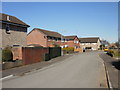
1
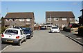
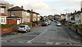
The far end of Lundy Drive, St Julians, Newport
Lundy Drive is the longest road in an area named after British islands. The other 'island' roads all connect with it. The other end of Lundy Drive connects with St Julians Road.
Image: © Jaggery
Taken: 4 Mar 2010
0.03 miles
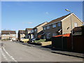
2
Raphael Close, Newport
Viewed from Firbank Avenue
Image: © Jaggery
Taken: 20 Aug 2009
0.03 miles
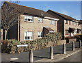
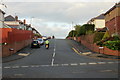
3
Lundy Drive, St Julians, Newport
Viewed from the corner of Shetland Close.
Image: © Jaggery
Taken: 25 Feb 2010
0.04 miles
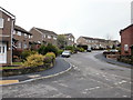
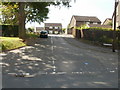
4
Ramsey Walk Close, St Julians, Newport
Houses on the south side of Ramsey Walk Close, viewed from the corner of Caldy Close.
Shown on the online Ordnance Survey map as a part of Caldy Close, but the street sign in the lower right of the photo disagrees.
Image: © Jaggery
Taken: 4 Mar 2010
0.04 miles
5
Westray Close, St Julians, Newport
Viewed from the corner of Lundy Drive. Streets in this area are named after British islands.
Image: © Jaggery
Taken: 4 Mar 2010
0.04 miles
6
Bardsy Close, St Julians, Newport
Viewed from the corner of Lundy Drive.
Image: © Jaggery
Taken: 4 Mar 2010
0.04 miles
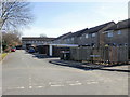
7
Ramsey Walk, St Julians, Newport
Houses at the western end of Ramsey Walk, which continues, beyond the right edge of the photo, to the far end of Lundy Drive.
Image: © Jaggery
Taken: 4 Mar 2010
0.04 miles
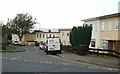
8
Caldy Close, St Julians
Viewed from Heather Road.
Image: © Jaggery
Taken: 24 Sep 2009
0.06 miles
9
Firbank Crescent, Newport
Viewed from Firbank Avenue.
Image: © Jaggery
Taken: 1 Nov 2009
0.08 miles
10
Firbank Avenue, Newport
Viewed from St Julians Road.
Image: © Jaggery
Taken: 1 Nov 2009
0.08 miles