IMAGES TAKEN NEAR TO
Rosemary Lane, CHEPSTOW, NP16 7LU
Introduction
This page details the photographs taken nearby to Rosemary Lane, NP16 7LU by members of the Geograph project.
The Geograph project started in 2005 with the aim of publishing, organising and preserving representative images for every square kilometre of Great Britain, Ireland and the Isle of Man.

There are currently over 7.5m images from over14,400 individuals and you can help contribute to the project by visiting https://www.geograph.org.uk
Image Map
Images are licensed for reuse under creativecommons.org/licenses/by-sa/2.0
Notes
- Clicking on the map will re-center to the selected point.
- The higher the marker number, the further away the image location is from the centre of the postcode.
Image Listing (28 Images Found)
Images are licensed for reuse under creativecommons.org/licenses/by-sa/2.0
Image
Details
Distance
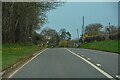
1
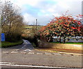
Rosemary Lane, Wibdon
Viewed across the A48. The blue signs on the left state that Rosemary Lane is a single track road, unsuitable for heavy goods vehicles. There are no passing places for 1 mile ahead.
Image: © Jaggery
Taken: 1 Jan 2013
0.10 miles
2
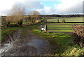
Track through Oldbury Field, Stroat
Viewed from the edge of the A48 Gloucester Road.
Image: © Jaggery
Taken: 1 Jan 2013
0.11 miles
4
Wibdon Fruit Farm
Viewed across the A48 Gloucester Road. Rosemary Lane http://www.geograph.org.uk/photo/3278547 is a few metres beyond the left edge of the view.
Image: © Jaggery
Taken: 1 Jan 2013
0.13 miles
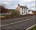
6
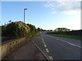
Bus stop on the A48 near High Hall Farm
Towards Gloucester.
Image: © JThomas
Taken: 17 Oct 2019
0.14 miles
7
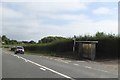
Bus shelter by A48 near Wibdon
This looks as if it has seen better days.
Image: © David Smith
Taken: 3 Aug 2018
0.15 miles
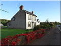
8
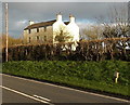
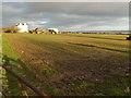
Farmhouse, High Hall Farm, Stroat
Viewed across the A48 between Chepstow and Lydney.
Image: © Jaggery
Taken: 1 Jan 2013
0.15 miles
9
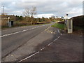
Wibdon bus shelters
Located alongside the A48 Gloucester Road, on the bus route between Chepstow and Lydney.
Image: © Jaggery
Taken: 1 Jan 2013
0.15 miles
10
High Hall Farm, Stroat
Viewed from a field gate alongside the A48 Gloucester Road.
Image: © Jaggery
Taken: 1 Jan 2013
0.16 miles