1
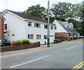
Libanus Primary School, Blackwood
Located on the west side of Libanus Road.
Image: © Jaggery
Taken: 24 May 2011
0.03 miles
2
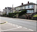
Libanus Road houses, Blackwood
The houses are on the southern section of Libanus Road, which runs west to east, viewed from near the corner of the T-junction with the section of Libanus Road which runs roughly north to south.
Image: © Jaggery
Taken: 24 May 2011
0.04 miles
3
Southern edge of Libanus Primary School, Blackwood
The school http://www.geograph.org.uk/photo/2425798 occupies a site 110 metres long by 50 metres wide on the west side of Libanus Road.
Image: © Jaggery
Taken: 24 May 2011
0.04 miles
4
Divisional Police Headquarters, Blackwood
Part of the Gwent Police Force, viewed across Blackwood Road near the Blackwood/Pontllanfraith boundary.
Image: © Jaggery
Taken: 22 Aug 2013
0.05 miles
5
Houses at the Libanus Road junction, Blackwood
Viewed across Blackwood Road which becomes High Street, Blackwood beyond the traffic lights.
The left turn is into Libanus Road.
Image: © Jaggery
Taken: 22 Aug 2013
0.05 miles
6
Divisional Police Headquarters, Blackwood
Image: © John Lord
Taken: 24 Aug 2017
0.05 miles
7
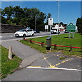
Southern boundary of Blackwood
The view along Blackwood Road (A4048) from the northern edge of Pontllanfraith.
Blackwood (Coed Duon in Welsh), a town with about 23,000 inhabitants, is twinned with Protivin in the Czech Republic. Embarrassingly, the name is misspelt as Protovin on the green sign...
Image: © Jaggery
Taken: 20 Jan 2011
0.06 miles
8
Houses near the southern end of High Street, Blackwood
On the west side of the B4251 High Street on the approach to the B4254 crossroads.
Image: © Jaggery
Taken: 17 May 2018
0.08 miles
9
Southern boundary of Blackwood
Viewed from Courthouse car park http://www.geograph.org.uk/photo/3615918 in Pontllanfraith. The boundary sign shows that Blackwood is twinned with Protivin (in the Czech Republic). The mis-spelling Protovin seen here http://www.geograph.org.uk/photo/2240003 in January 2011 has been corrected.
Image: © Jaggery
Taken: 22 Aug 2013
0.08 miles
10
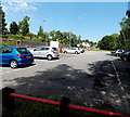
Courthouse car park, Pontllanfraith
The Caerphilly County Borough Council car park is on the east side of Blackwood Road,
near the former County Court, now Chambers House Small Business Centre. http://www.geograph.org.uk/photo/3615888
Image: © Jaggery
Taken: 22 Aug 2013
0.08 miles


