Southern boundary of Blackwood
Introduction
The photograph on this page of Southern boundary of Blackwood by Jaggery as part of the Geograph project.
The Geograph project started in 2005 with the aim of publishing, organising and preserving representative images for every square kilometre of Great Britain, Ireland and the Isle of Man.

There are currently over 7.5m images from over 14,400 individuals and you can help contribute to the project by visiting https://www.geograph.org.uk
Southern boundary of Blackwood
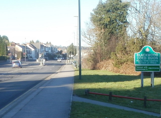
Image: © Jaggery Taken: 20 Jan 2011
The view along Blackwood Road (A4048) from the northern edge of Pontllanfraith. Blackwood (Coed Duon in Welsh), a town with about 23,000 inhabitants, is twinned with Protivin in the Czech Republic. Embarrassingly, the name is misspelt as Protovin on the green sign...
Images are licensed for reuse under creativecommons.org/licenses/by-sa/2.0
Image Location
Latitude
51.65942
Longitude
-3.192645